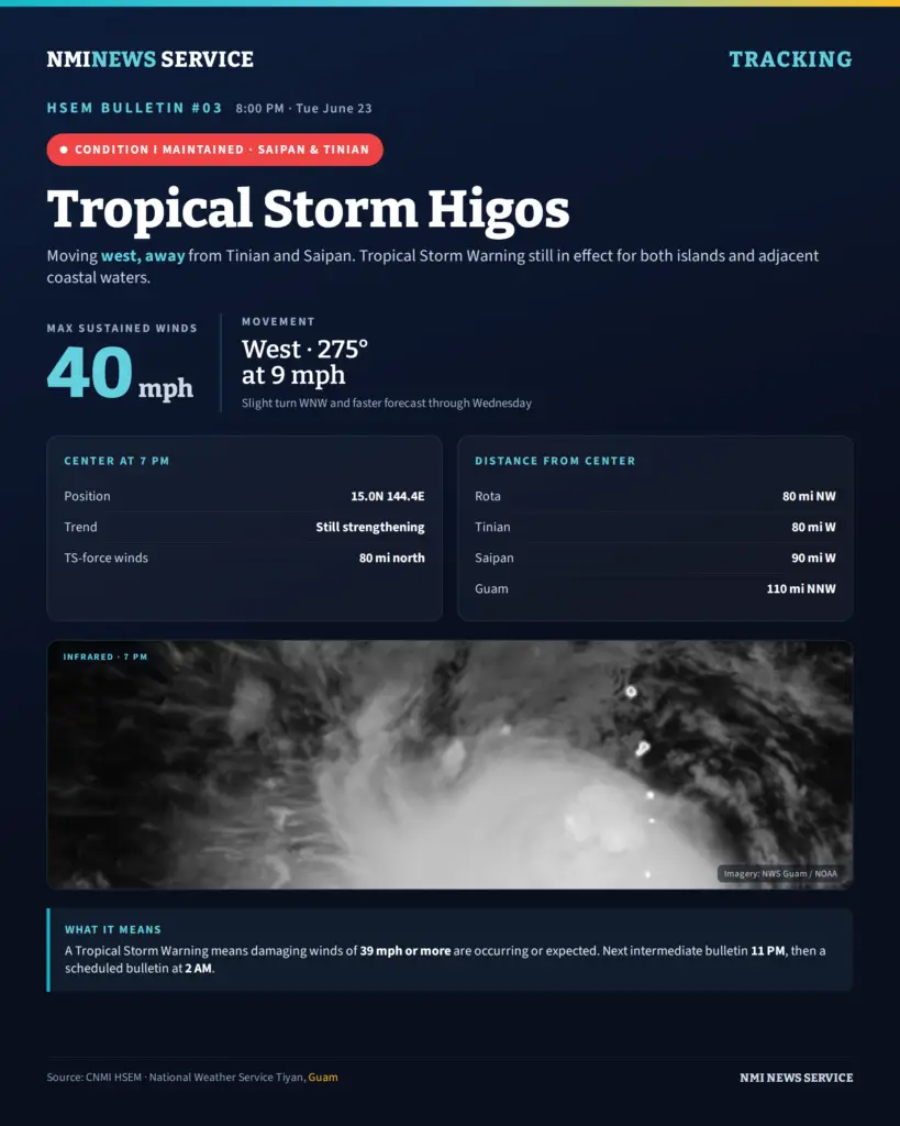
SAIPAN — Tropical Storm Higos continued to track west and away from Tinian and Saipan on Tuesday evening, but the Commonwealth’s emergency managers kept Tropical Storm Condition I in place for both islands as the system stayed within range and forecasters warned it could still strengthen.
In Bulletin #03, issued at 8 p.m., the CNMI Emergency Operations Center said the center of Higos was located near 15.0 degrees north, 144.4 degrees east at 7 p.m., about 80 miles west of Tinian, 90 miles west of Saipan and 80 miles northwest of Rota. The storm was about 110 miles north-northwest of Guam.
Higos was moving west at 9 mph with maximum sustained winds of 40 mph. The EOC said the storm is expected to make a slight turn toward the west-northwest and pick up forward speed through Wednesday, and that it is still forecast to intensify over that period. Tropical storm-force winds extend up to 80 miles north of the center.
Governor David M. Apatang maintained Tropical Storm Condition I for Saipan and Tinian as of 8 p.m. The condition means winds of 39 mph or more are expected or occurring. A Tropical Storm Warning also remains in effect for both islands and their adjacent coastal waters, meaning damaging winds of 39 mph or more are occurring or will occur shortly.
The EOC also listed the storm’s distance from the Northern Islands, placing it about 205 miles south-southwest of Alamagan, 235 miles south-southwest of Pagan and 270 miles south-southwest of Agrihan.
Emergency managers urged residents to stay tuned to local media and NOAA Weather Radio for the latest forecasts and advisories. Residents in the Northern Islands can reach the EOC State Warning Point by high-frequency single side band radio on frequency 5.205.0, or by phone at 237-8000 or 664-8000.
An intermediate bulletin is scheduled for 11 p.m., followed by the next regular bulletin at 2 a.m.