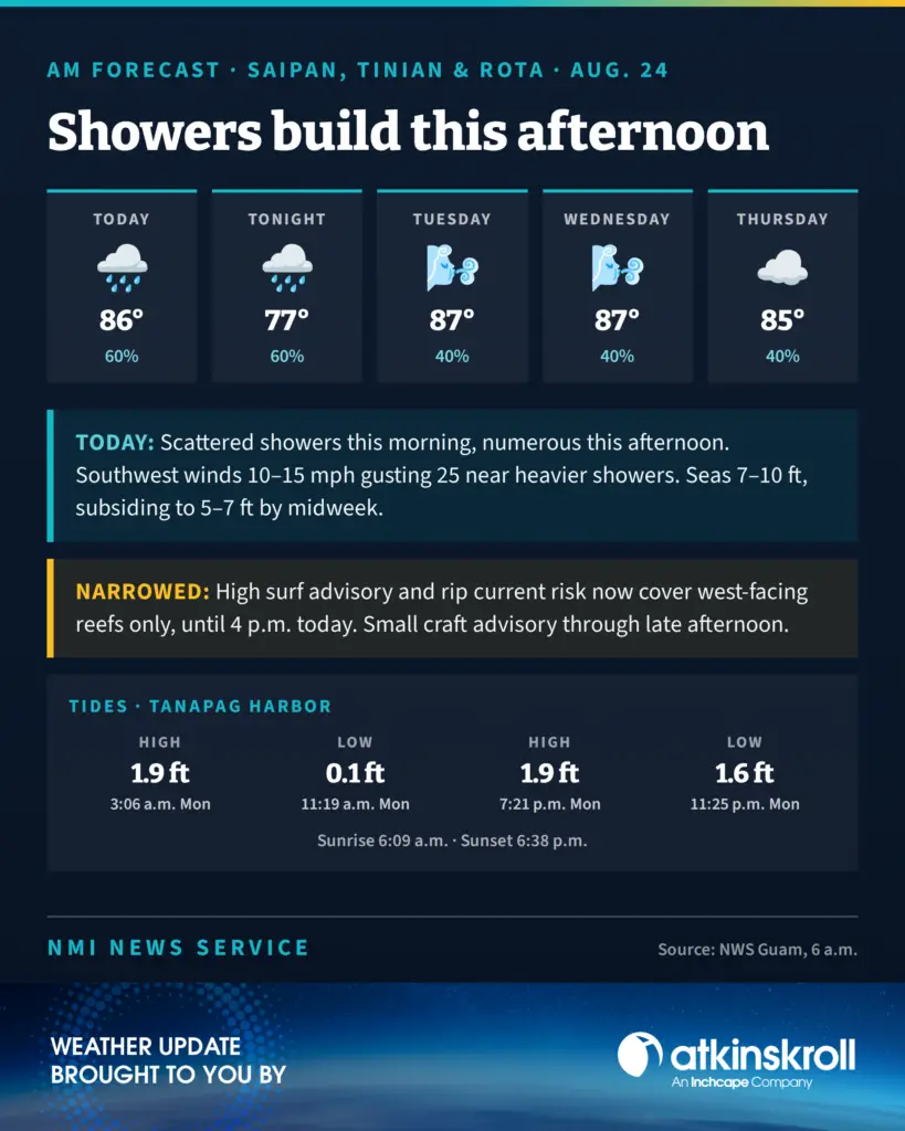

SAIPAN — Scattered showers this morning turn numerous across Saipan, Tinian and Rota this afternoon, with isolated thunderstorms and southwest winds of 10 to 15 mph gusting to 25 near heavier showers, the National Weather Service said in its 6 a.m. Monday zone forecast.
Highs reach around 86 with a 60 percent chance of showers today and again tonight, when numerous evening showers taper to scattered after midnight and locally heavy showers are possible. Tuesday and Wednesday ease to a 40 percent chance with highs around 87, holding at 40 percent into Thursday.
The advisories narrowed. The high surf advisory and high rip current risk now cover west-facing reefs only, down from north- and west-facing, and both run until 4 p.m. today. The small craft advisory remains in effect through late this afternoon.
Seas run 7 to 10 feet today, driven by significant southwesterly swell from the monsoon pattern and Tropical Depression 19W, now well north-northwest of Yap. Combined seas are expected to gradually subside to 5 to 7 feet around midweek and 4 to 6 feet late in the week, with winds easing to light to moderate beginning Tuesday.
An unsettled but disorganized monsoon pattern continues across the Marianas this week, bringing scattered showers and isolated thunderstorms that become numerous and locally heavy at times.
Tides at Tanapag Harbor: high of 1.9 feet at 3:06 a.m., low of 0.1 feet at 11:19 a.m., high of 1.9 feet at 7:21 p.m., and low of 1.6 feet at 11:25 p.m. Sunrise was 6:09 a.m.; sunset is 6:38 p.m.