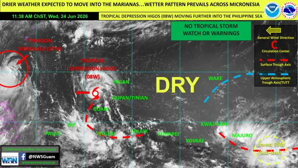
SAIPAN — Drier weather is expected to move into the Marianas over the next day or two as Tropical Depression Higos tracks further into the Philippine Sea, while a wetter pattern continues across much of the rest of Micronesia, the National Weather Service in Tiyan, Guam said in its weekly regional outlook.
In the outlook, prepared by lead meteorologist Joshua Schank, the weather service said Higos is moving away from the Marianas with no further direct impacts expected. Scattered showers and isolated thunderstorms trailing behind the system should shift westward, allowing drier conditions to settle in. No watches or warnings are in effect.
The weather service said two troughs, one trailing from Higos toward Yap and Chuuk and another near the Marshall Islands, are producing scattered to numerous showers and isolated thunderstorms, some with heavy rainfall and gusty winds. As those features move west, showers and storms are expected to spread toward Palau, Pohnpei and Kosrae, supporting an overall wet pattern near and south of 10 degrees north.
On the drought front, the weather service said the dry stretch in late May and early June had left Tinian and Saipan abnormally dry, but recent rainfall from Higos should help relieve those conditions. Normal to above-average rainfall is expected across most of the region over the next two weeks.
Forecasters said the Joint Typhoon Warning Center is monitoring an area of disturbed weather east-southeast of the Marshall Islands near the Date Line, which it has designated Invest 95W and rated as a sub-low for development, meaning formation into a tropical cyclone is unlikely in the next few days. The weather service noted that the current El Niño pattern tends to shift tropical cyclone development eastward in the region, and the area will be watched over the coming weeks.
The weather service is also tracking Typhoon Mekkhala, west of its area of responsibility and northeast of the Philippines.