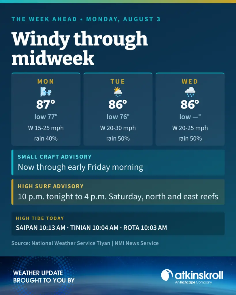



Saipan — Breezy and windy conditions will hold across Saipan, Tinian and Rota through midweek as a monsoon surge builds, the National Weather Service in Tiyan said Monday morning.
Monday will be breezy and mostly cloudy with scattered showers and isolated thunderstorms. West winds will blow 15 to 25 mph, highs will reach around 87 and the chance of showers is 40 percent. Overnight lows will fall near 77.
Tuesday turns windy with west winds 20 to 30 mph and gusts to 40 mph possible near heavier showers. Highs will reach around 86 and the chance of showers rises to 50 percent. Tuesday night will be cloudy with numerous locally heavy showers and isolated thunderstorms, lows around 76 and a 70 percent chance of showers. Wednesday stays breezy with west winds 20 to 25 mph and gusts to 35 mph possible.
A small craft advisory remains in effect through early Friday morning. Seas will run 9 to 10 feet through Tuesday night and 8 to 10 feet Wednesday. Forecasters said moderate to strong westerlies will prevail for at least several more days and that combined seas will exceed 10 feet across the coastal waters, keeping conditions hazardous for much of the week.
The high surf advisory and the high risk of rip currents both remain in effect along north and east facing reefs through Saturday afternoon.
Forecasters said the long period east to northeast swell from distant Typhoon Dolphin is moving through the Marianas and will shift north over the next day or so before turning northwest. A developing monsoon pattern will add increasing southwesterly swell over the coming days.