NWS Aydlett: Invests 92W, 93W Not a Threat to Marianas, but Dry Conditions and Fires Are
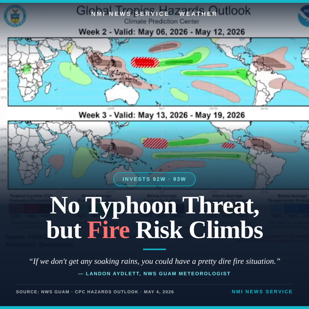
SAIPAN — Two tropical disturbances tracking through Western Micronesia are not expected to threaten the Marianas, but strong trade winds and continued dry conditions are setting up dangerous wildfire conditions through midweek, U.S. National Weather Service Guam meteorologist Landon Aydlett told NMI News Service Monday.
Fair Weather for Marianas Into Next Week; NWS Watching for Possible Disturbance in FSM

SAIPAN — Fair weather will persist across the Marianas through the weekend and into early next week, according to a regional weather outlook issued Friday by National Weather Service Guam Weather Coordination Meteorologist Landon Aydlett.
Fair Weather Returns to Marianas as Sinlaku Swell Subsides, No New Storm Threats on Horizon

SAIPAN — Fair weather has returned to Guam and the CNMI in the wake of Typhoon Sinlaku, with only a few spotty showers expected through the weekend and no tropical cyclone development threats within the National Weather Service Guam area of responsibility, according to the weekly regional outlook issued Tuesday by Warning Coordination Meteorologist Landon Aydlett.
Sinlaku Exits Region; NWS Warns of Dangerous Heat for Those Without Power as Winds Go Calm

SAIPAN — Tropical Storm Sinlaku has exited the National Weather Service Guam area of responsibility, but forecasters are now warning residents without power to prepare for dangerous heat as winds go calm over the Marianas in the coming days.
Typhoon Warning Cancelled for Saipan and Tinian; Sinlaku Exits CNMI as Category 2

SAIPAN — The Typhoon Warning for Saipan and Tinian has been cancelled, marking the end of direct typhoon threat to the main CNMI islands as Typhoon Sinlaku weakened to 100 mph and moved 290 miles north of Saipan Friday morning, according to a weather alert prepared by NWS Guam meteorologist Landon Aydlett.
NWS: Sinlaku at Peak Intensity, Direct Hit on Tinian Forecast Tuesday Afternoon

SAIPAN — Super Typhoon Sinlaku has likely reached peak intensity at 180 mph sustained winds and the latest forecast track calls for a direct passage over Tinian on Tuesday afternoon, with wind gusts capable of exceeding 200 mph, according to a weather alert issued Monday morning by NWS Guam meteorologist Landon Aydlett.
Governor Urges CNMI Residents to Prepare Now as Typhoon Sinlaku Closes In

SAIPAN — Governor David M. Apatang on Sunday urged all residents of the Commonwealth to secure their homes, gather essential supplies and stay informed through official channels as Typhoon Sinlaku continues to intensify and bear down on the Marianas.
NWS: Sinlaku Track Shifts North, Now Targeting Rota as Category 4; Super Typhoon Status Briefly Possible

SAIPAN — The forecast track for Typhoon Sinlaku shifted significantly overnight, with the Joint Typhoon Warning Center’s 7 a.m. Sunday track now showing the storm passing directly over Rota as a Category 4 typhoon, National Weather Service meteorologist-in-charge Brandon Aydlett said Sunday morning.
NWS: Typhoon Sinlaku Forecast at 140 MPH at Guam Landfall; Watch Now Covers All Four Marianas Islands

SAIPAN — National Weather Service meteorologist-in-charge Brandon Aydlett and lead forecaster Joshua Schenck delivered a sobering Facebook Live briefing Saturday afternoon, confirming that Typhoon Sinlaku is now forecast to arrive at Guam with 140 mph sustained winds and gusts up to 170 mph, conditions comparable to Typhoon Mawar in 2023, while a Typhoon Watch is now in effect for all four Marianas islands including Guam, Rota, Tinian and Saipan.
NWS Meteorologist-in-Charge Brandon Aydlett Warns of Category 4 Track; Marianas Should Expect Conditions to Deteriorate by Monday Midday

SAIPAN — National Weather Service meteorologist-in-charge Brandon Aydlett told Good Morning Marianas Saturday morning that the latest forecast track from the Joint Typhoon Warning Center reflects a Category 4 typhoon moving through the Marianas near Guam, and urged residents across the island chain to use the remaining good weather days to complete preparations before conditions deteriorate Monday.