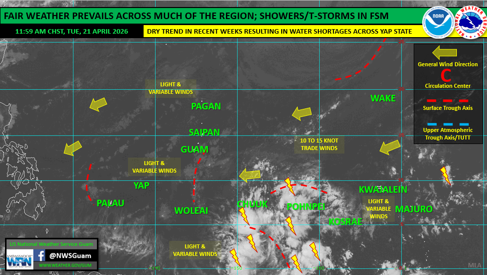
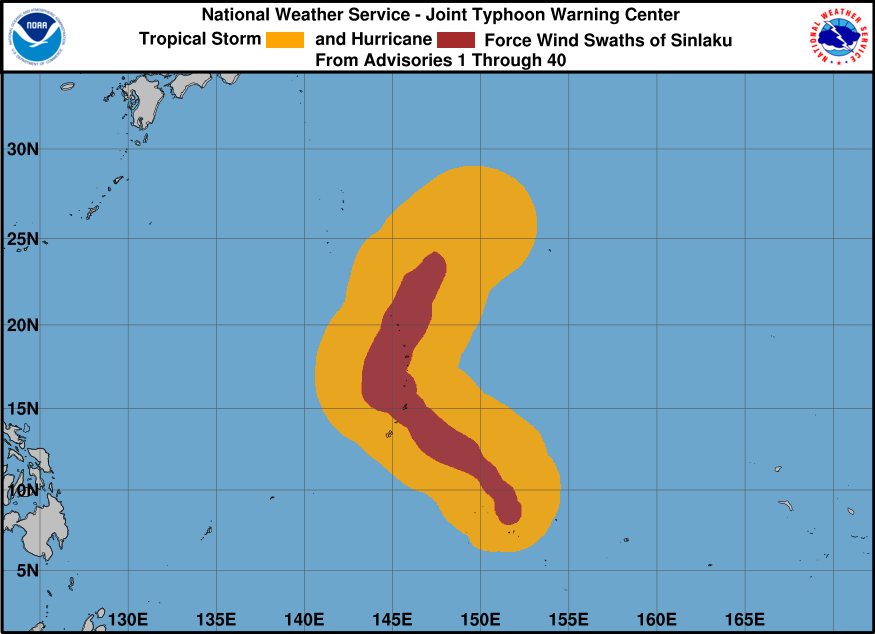
SAIPAN — Fair weather has returned to Guam and the CNMI in the wake of Typhoon Sinlaku, with only a few spotty showers expected through the weekend and no tropical cyclone development threats within the National Weather Service Guam area of responsibility, according to the weekly regional outlook issued Tuesday by Warning Coordination Meteorologist Landon Aydlett.
Winds across the Marianas are currently light and variable, shifting toward the northeast by Wednesday and becoming breezy as trade winds build across the region. Seas and surf continue to subside with no advisories currently in effect. Combined seas of 5 to 7 feet will drop to between 4 and 5 feet by Thursday before building again this weekend as trade wind swell increases. Residents and visitors should be aware of a low to moderate rip current risk along all reefs and beaches.
No warnings, watches or advisories are in effect for the Marianas. There are no suspect areas for tropical cyclone development through the weekend.
Elsewhere in the region, a broad disturbance is generating showers and thunderstorms across Chuuk and Pohnpei states in the central Federated States of Micronesia. NWS Guam also noted a steady drying trend across Yap State, with some islands and atolls reporting browning vegetation and water shortages. Below-normal rainfall is expected for Palau and the western FSM in the coming weeks, which may also reflect an ongoing transition toward El Nino conditions.