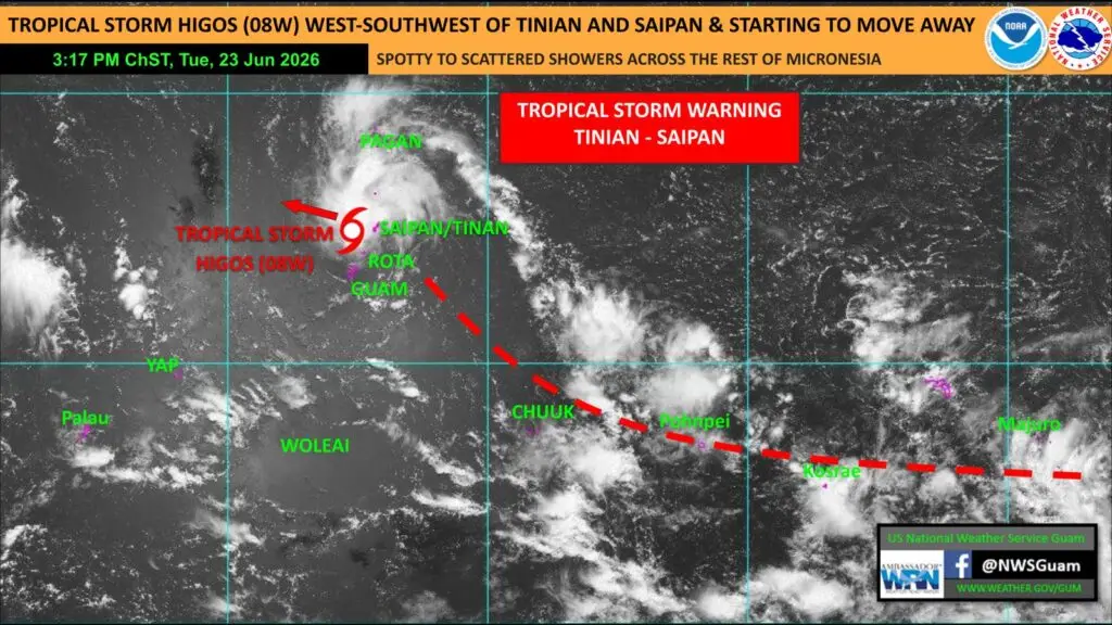
SAIPAN — Tropical Storm Higos was moving west of the Marianas and beginning to pull away from Saipan and Tinian on Tuesday afternoon, the National Weather Service in Guam said, though a forecaster cautioned that a shift in the storm’s heaviest weather could still bring tropical-storm-force winds to the two islands into the evening.
In a Regional Weather Outlook issued at 3:22 PM, NWS Guam Lead Meteorologist and Acting Science and Operations Officer Joshua Schank said the Joint Typhoon Warning Center placed Higos west-southwest of Tinian and Saipan as of 1:00 PM, near 14.8 degrees north and 145.1 degrees east, moving west-northwest at 10 miles per hour.
The heaviest showers, thunderstorms and gusty winds were located in the convection near and west-northwest of the center, Schank said. If that band of weather stays west-northwest of the center, the risk for tropical-storm-force winds at Saipan and Tinian will gradually decrease. But if the convection wraps around the center, the islands could still see periods of heavy rainfall and tropical-storm winds near 40 miles per hour.
Schank said the potential for that wrap-around was low but worth monitoring through the evening hours. Tropical storm conditions are not expected at Guam and Rota as Higos continues to move away to the west-northwest.
Across the rest of Micronesia, satellite imagery showed spotty to scattered showers over Palau and Yap, with scattered showers and isolated thunderstorms developing around Chuuk, Pohnpei, Kosrae and the Marshall Islands along a near-equatorial trough. That pattern is expected to continue over the next few days as Higos moves deeper into the Philippine Sea and away from the region.