
SAIPAN — Tropical Depression 17W is getting stronger while its long-anticipated turn to the northwest keeps forecasters waiting, with the system expected to reach tropical storm strength late Wednesday and possibly typhoon intensity by Friday, the National Weather Service in Guam said in its 1 p.m. update.
The Joint Typhoon Warning Center’s third bulletin on the system placed 17W near 8.2 degrees north, 154.1 degrees east, about 140 nautical miles east-northeast of Weno, Chuuk, as of 1 p.m. Wednesday. Maximum sustained winds had increased to 35 mph, and the depression had been tracking west-southwest at 5 mph.
The turn toward the northwest is still expected Wednesday, the weather service said, but the delay carries a cost for Micronesia. “The longer we wait for that turn to the northwest, the longer 17W will be in the vicinity of the islands and atolls across Chuuk and Pohnpei states,” the update said.
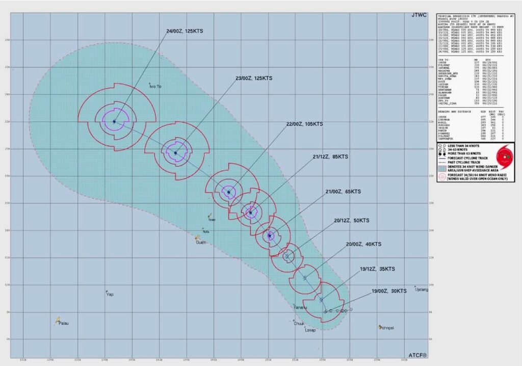
The warning center’s forecast shows steady intensification once the system lifts out, with the track graphic depicting 17W reaching typhoon strength Friday and peaking near 125 knots, about 145 mph, over the weekend as it moves through the waters northeast of the Marianas.
Heavy showers and thunderstorms are concentrated near and just east of Chuuk Lagoon, driven by a strong belt of west winds near and south of the depression. Widespread showers, locally heavy rainfall, strong gusty winds and hazardous seas and surf remain in the forecast across Chuuk State, and the weather service warned that flash flooding and mudslides will be possible if heavy showers move onshore, with the ground already saturated from days of rain.
Tropical Storm Watches remain in effect for Fananu, Ulul, Chuuk, Losap, Lukunor, Pakin and Sapwuafik, meaning tropical storm conditions of 39 to 73 mph are possible.
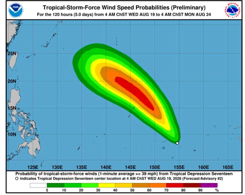
For the Marianas, the guidance is unchanged from the morning: forecast tracks still keep 17W east of Guam and Saipan, but the passage will be uncomfortably close later this week. “There’s still time for any number of changes and shifts,” the weather service said, urging residents to keep a close watch as the system evolves. No watches or warnings are in effect for the Marianas.
Earlier Wednesday, NWS Guam meteorologist-in-charge Brandon Aydlett said the current track is focused on the CNMI’s far northern islands this weekend, perhaps as close as Pagan, and that Saturday’s rescheduled Liberation Day parade would mean tough conversations for decision-makers over the next two days.