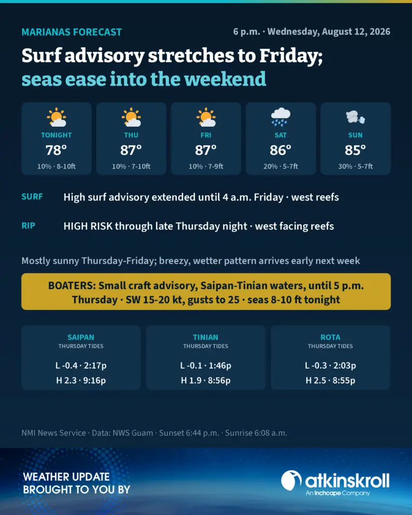
SAIPAN — The high surf advisory for west facing reefs across the Marianas has been extended until 4 a.m. Friday, the National Weather Service in Guam said in its 6 p.m. forecast Wednesday, with a high rip current risk holding through late Thursday night.
On the water, the small craft advisory for Saipan and Tinian coastal waters remains in effect until 5 p.m. Thursday. Southwest winds of 15 to 20 knots with frequent gusts to 25 knots are combining with a significant west swell to produce seas of 8 to 10 feet tonight, keeping conditions hazardous to small craft through at least Thursday afternoon.
In a special marine advisory issued through the CNMI Emergency Operations Center, Governor David M. Apatang advised all mariners, especially those operating smaller vessels, to avoid navigating in hazardous conditions. Rota’s waters are forecast to stay just below small craft advisory levels through the end of the week, with seas of 7 to 9 feet easing gradually.
Ashore, the forecast stays quiet. Tonight is partly cloudy with isolated light showers, southwest winds of 10 to 15 mph and lows around 78. Thursday and Friday turn mostly sunny with highs around 87 and only a 10 percent chance of showers.
The pattern shifts heading into next week. Saturday brings a 20 percent chance of showers and thunderstorms with highs around 86, and Sunday through Monday turn breezy and mostly cloudy with a 30 percent chance of showers as the forecast trends wetter across the Marianas.
Seas around Saipan and Tinian ease to 7 to 9 feet Thursday night and Friday, then 5 to 7 feet over the weekend.
Thursday’s tides run high at 7 a.m. and again in the 9 p.m. hour at Tanapag Harbor, with an afternoon low of minus 0.4 feet at 2:17 p.m. Tinian sees its low of minus 0.1 feet at 1:46 p.m. and Rota’s low of minus 0.3 feet comes at 2:03 p.m. Sunset Wednesday is 6:44 p.m., with sunrise Thursday at 6:08 a.m.