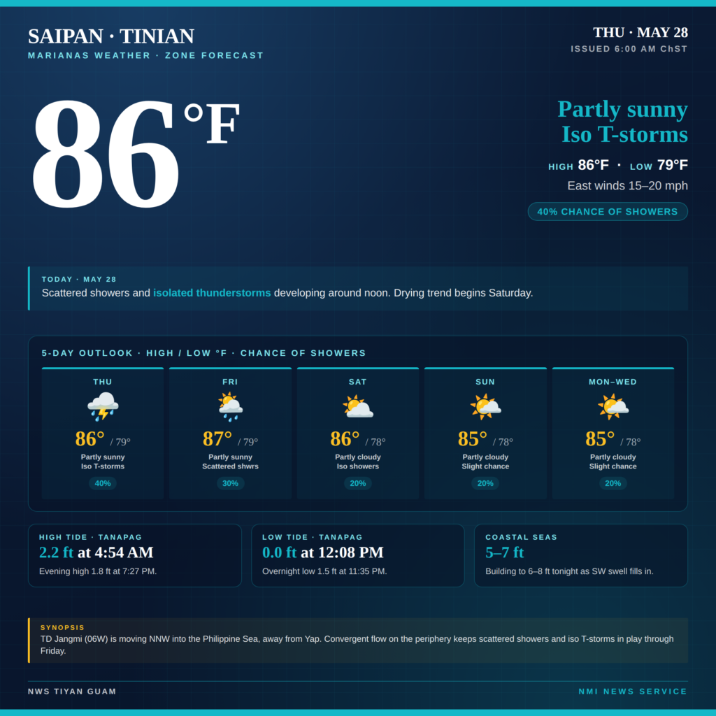
SAIPAN — Saipan and Tinian residents can expect another wet afternoon Thursday with scattered showers and isolated thunderstorms developing around noon, the National Weather Service in Tiyan said in its 6 a.m. zone forecast.
Highs Thursday should reach around 86 degrees with east winds 15 to 20 mph and a 40% chance of showers. Scattered showers and isolated thunderstorms are expected to continue overnight, with lows around 79 degrees.
Friday holds a similar pattern with highs near 87 degrees, southeast winds 10 to 15 mph, and a 30% chance of showers. The pattern dries out into the weekend, with Saturday partly cloudy and a 20% shower chance, and the forecast holding partly cloudy with isolated showers through Wednesday.
Rota faces a wetter trend Thursday night with a 50% chance of showers and isolated thunderstorms. Southeast winds Thursday could gust to 25 mph on Rota.
The Marianas remains on the far northeastern periphery of a convergent flow pattern set up by Tropical Depression Jangmi, designated 06W, which is moving north-northwest into the Philippine Sea and away from Yap. NWS said the convergent pattern has weakened over the past 12 hours but continues to seed scattered showers and isolated thunderstorms into Friday.
Coastal seas around Saipan and Tinian are running 5 to 7 feet and are expected to build to 6 to 8 feet by Thursday night as a southwest swell fills in. Rota coastal seas are running 6 to 8 feet.
At Tanapag Harbor on Saipan, Thursday tides are high tide 2.2 feet at 4:54 a.m., low tide flat at noon, high tide 1.8 feet at 7:27 p.m., and low tide 1.5 feet at 11:35 p.m.
The next NWS zone forecast update is expected later Thursday.