SAIPAN — Tropical Storm Hagupit is passing through Yap State and poses no direct threat to the Marianas, but trade winds, hazardous seas and strong rip currents will continue across Saipan, Tinian and Rota, the National Weather Service said in a Thursday morning weather alert.
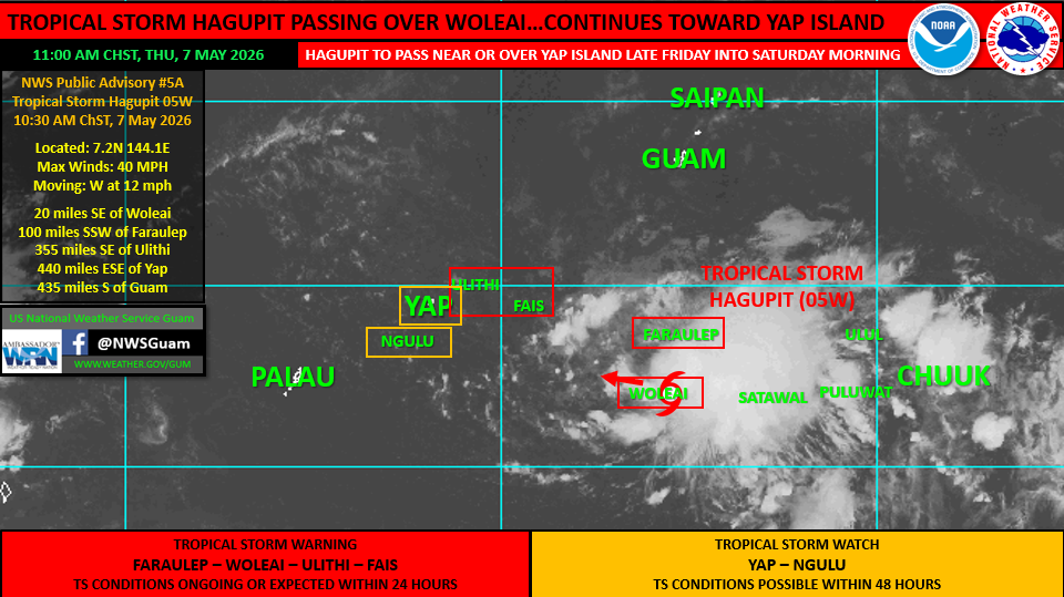
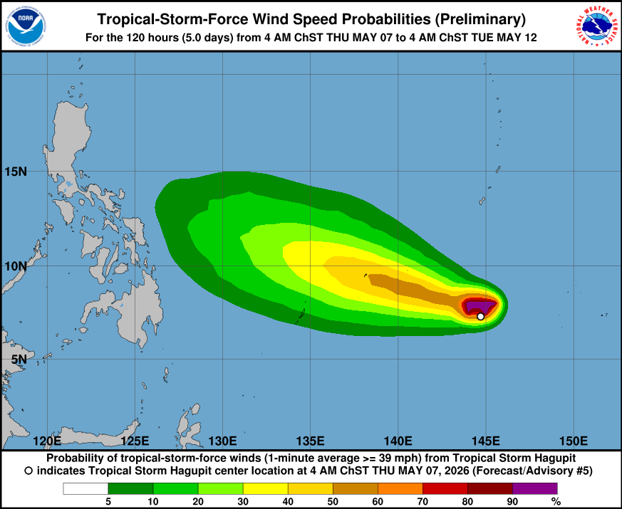
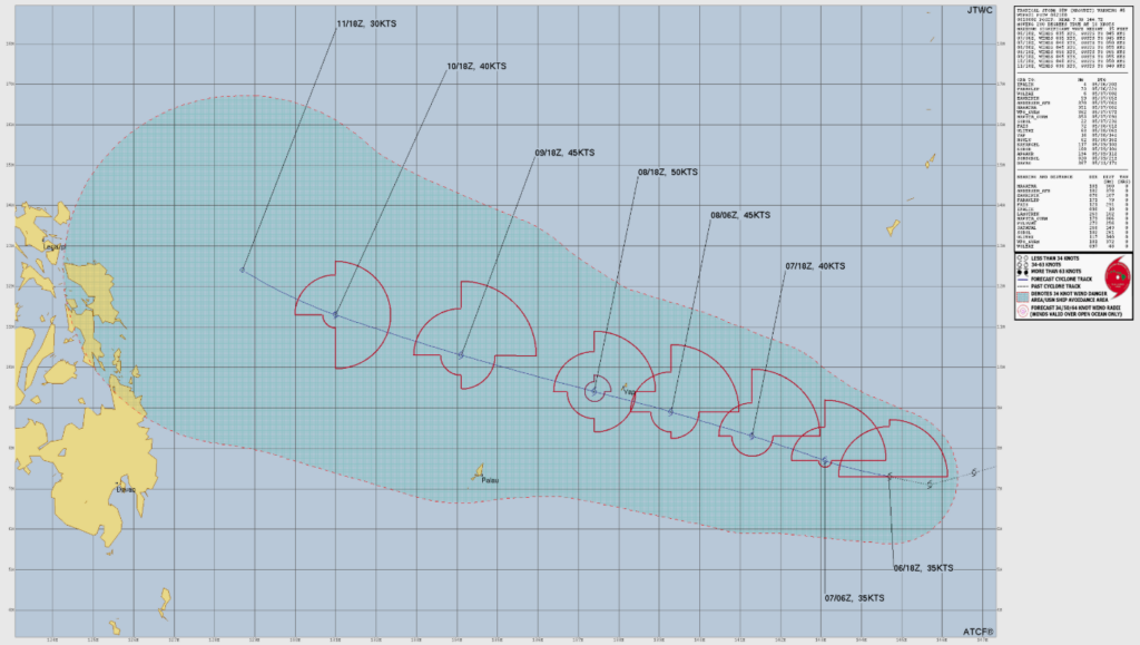
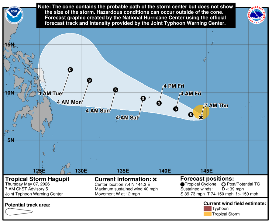
The system, designated 05W and now named Hagupit, was located 20 miles southeast of Woleai at 10 a.m. ChST Thursday, moving west at 12 mph with maximum sustained winds of 40 mph, NWS Guam said. It was 100 miles south-southwest of Faraulep and 440 miles east-southeast of Yap.
Hagupit is expected to gradually turn west-northwest with a decrease in forward speed over the next day or two, the agency said. It will continue a slow strengthening trend and may become a strong tropical storm with sustained winds greater than 58 mph as it nears Yap Proper.
The system is currently passing near or over Woleai and Ifalik in central Yap State, NWS said. As currently forecast, Hagupit will pass very near to or just south of Yap Proper late Friday night or early Saturday morning as a strong tropical storm.
A Tropical Storm Warning is in effect for Faraulep, Woleai, Ulithi and Fais. A Tropical Storm Watch is in effect for Yap and Ngulu.
NWS said residents across eastern Yap State should remain in safe shelter and avoid inter-island travel until Hagupit has passed. Residents across Ulithi, Fais, Yap Proper and Ngulu should rush preparedness plans and actions to completion before weather conditions begin to deteriorate.
Hagupit will track north of the Republic of Palau, but Palau residents should monitor forecasts in case of any southward shift in the projected track, NWS said.
For Guam and the CNMI, NWS said Hagupit is passing well south of the Marianas and poses no direct threat to the islands. However, trade winds will continue to surge with spotty showers, hazardous seas, surf and strong rip currents.
The High Rip Current Risk for east-facing reefs on Saipan, Tinian and Rota remains in effect through Sunday afternoon, per the prior NWS forecast. The Small Craft Advisory for Marianas waters remained in effect through Thursday afternoon.