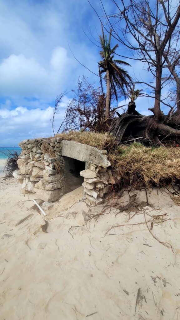
SAIPAN — Super Typhoon Sinlaku rearranged the eastern shoreline of Managaha Island and exposed a previously buried bunker not seen by living memory, Department of Public Lands Secretary Sixto Igisomar said in remarks shared from the island Thursday.
The storm shifted significant volumes of sand inland on the eastern side, moved trees back from the shoreline and uncovered structures that had been hidden beneath the sand, Igisomar said.
“I don’t know if anyone has ever seen this after the war,” Igisomar said. “It’s possible that somebody may have seen it. But for now, for us, at our age, it’s the first time we’ve seen it.”
The newly exposed bunker is located on the southeast portion of the island, Igisomar said.
Igisomar described the storm’s reshaping of Managaha as a natural recycling process. Sand that had previously been in the water on the western side of the island is now deposited inland, he said, and the same pattern has reshaped the eastern beach.
“What Mother Nature did here today, or to this storm, at least for our island here, Managaha, is made it beautiful,” Igisomar said. “I call it like recycling.”
Igisomar said the storm has exposed features on the island that were not previously visible, including a large overturned tree and the bunker. He also referenced a Department of Public Lands boat camp on the island.
The remarks come a day after DPL announced the closure of Managaha to general public access following an on-site assessment that identified biohazard, fire and unstable terrain hazards from the storm. The closure remains in effect until further notice.