Tropical Storm Hagupit to Pass Near or Over Yap Tonight; CNMI Not Under Threat
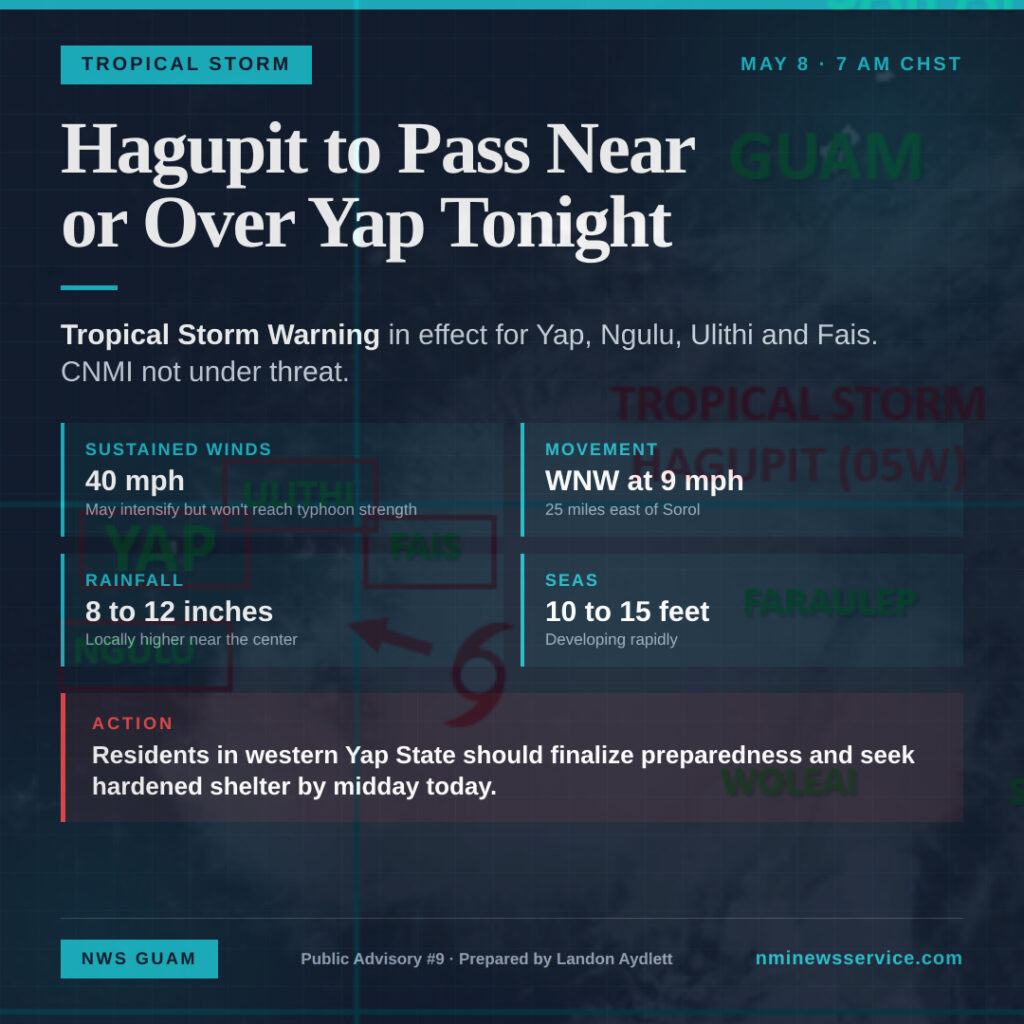
HAGÅTÑA — Tropical Storm Hagupit is on track to pass near or directly over Yap Proper overnight, with tropical storm warnings in effect for Yap, Ngulu, Ulithi and Fais, the National Weather Service in Guam said in its 10 a.m. ChST weather alert Friday.
Tropical Storm Hagupit Tracks Through Yap State; No Direct Threat to Marianas, NWS Says
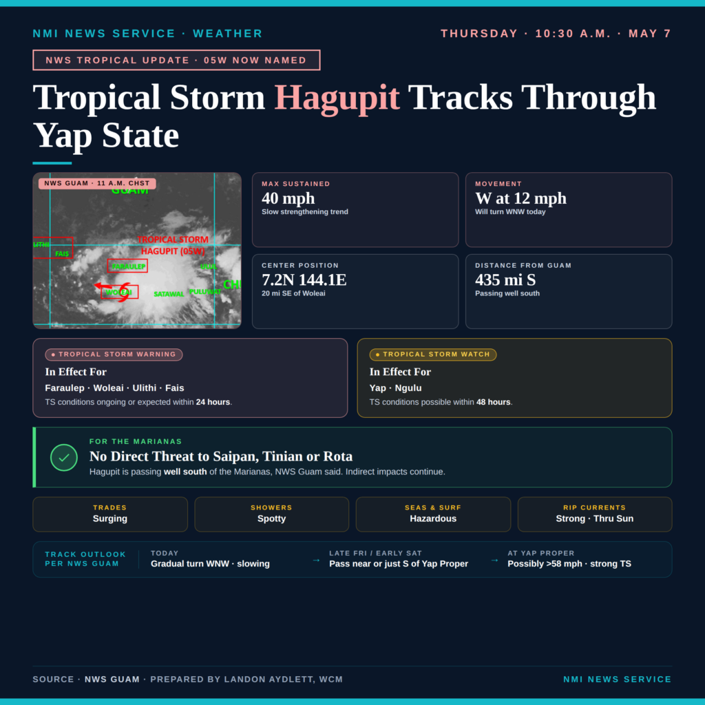
SAIPAN — Tropical Storm Hagupit is passing through Yap State and poses no direct threat to the Marianas, but trade winds, hazardous seas and strong rip currents will continue across Saipan, Tinian and Rota, the National Weather Service said in a Thursday morning weather alert.
Tropical Depression Nuri Now on “Life Support,” Forecaster Says; Gusty Winds and Heavy Rain Still Expected Through Friday

NWS Guam meteorologist says deep convection collapsed overnight, but remnant system will bring unsettled weather to the Marianas through the weekend
Tropical Depression Nuri Weakening Rapidly, May Dissipate Before Reaching Marianas
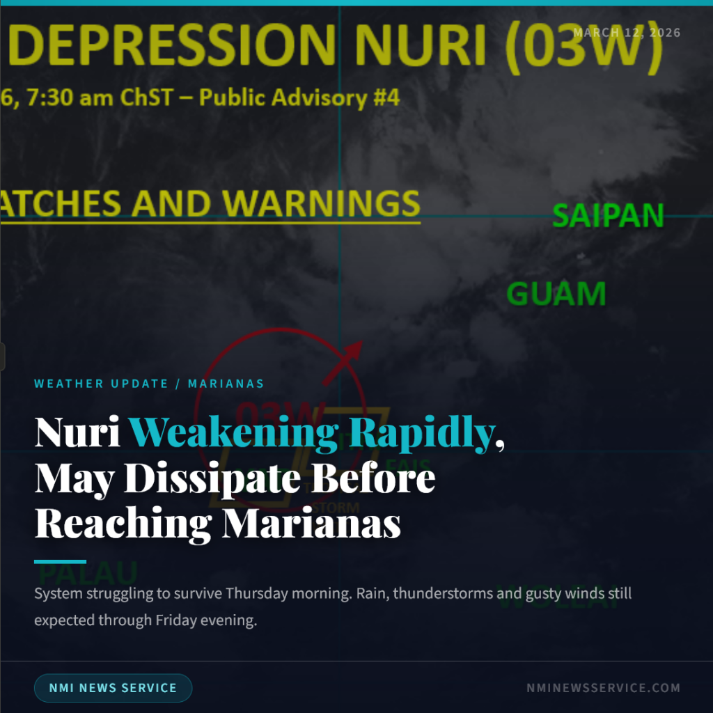
NWS Guam says system is struggling to survive but remnant circulation still expected to bring rain, gusty winds through Friday
Tropical Depression Nuri Forms, Forecast to Track Toward Northern CNMI by Weekend

NWS Guam upgrades 95W to TD Nuri; tropical storm watch in effect for Yap and Ulithi; passage north of Saipan possible early Saturday
Wind and Rain on the way!
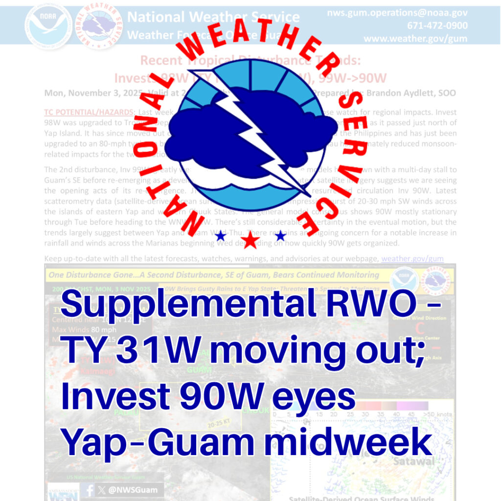
Heads up, Guam & CNMI: TY 31W is leaving, but Invest 90W is trying to spin up. Likely stationary thru Tue, then WNW–NNW with a Wed–Thu window between Yap & Guam. Expect rain/wind to tick up starting Wed.
So what the heck is a Hydrologic Outlook?
Hydrologic Outlook = early heads-up about possible flooding.
It’s issued by the National Weather Service when heavy rain is likely to cause flash flooding, urban/poor-drainage flooding, or small stream rises, but confidence/timing isn’t firm enough yet for a Watch.