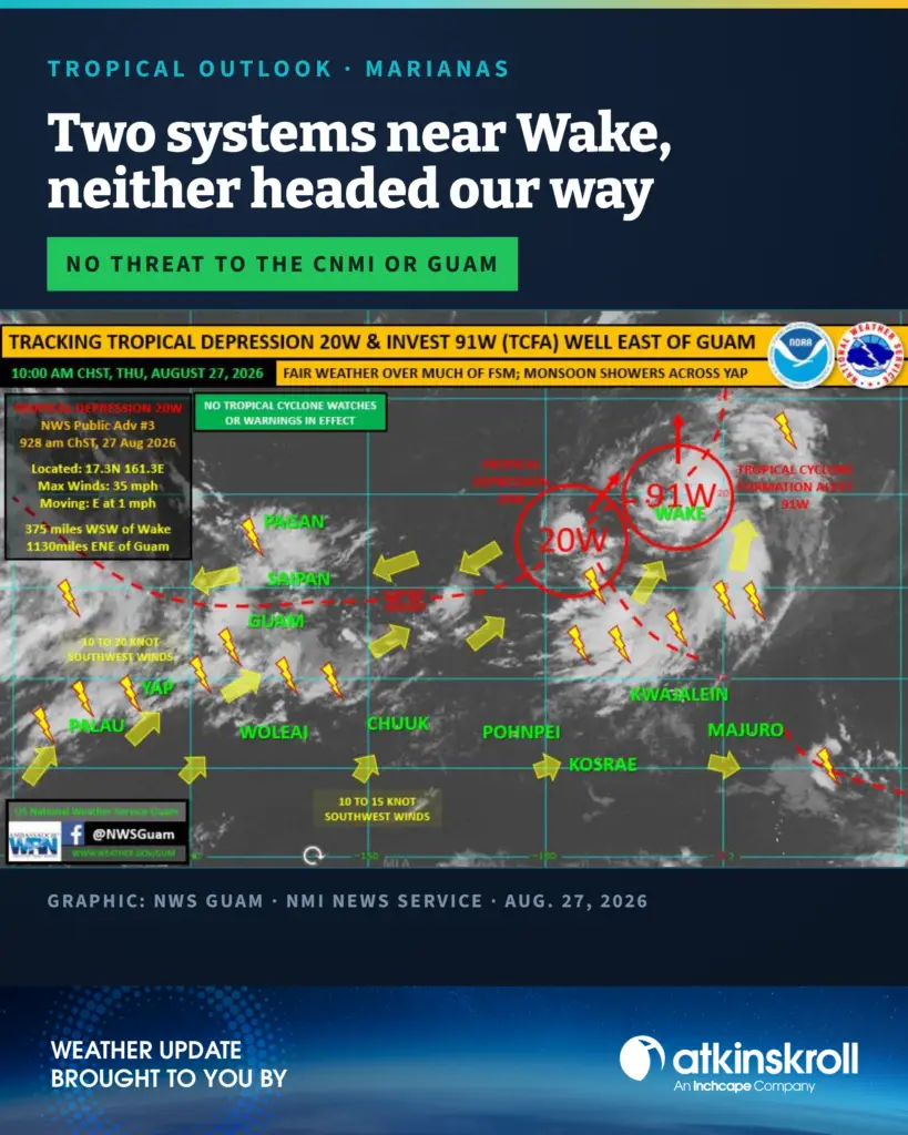

SAIPAN — Neither Tropical Depression 20W nor Invest 91W poses a threat to the CNMI, Guam, the FSM or the RMI, the National Weather Service in Guam said in a supplemental Regional Weather Outlook issued Thursday morning, as forecasters track both systems near Wake Island, far to the east-northeast of the Marianas.
Tropical Depression 20W, described as compact and disorganized, was located 375 miles west-southwest of Wake Island and 1,130 miles east-northeast of Guam as of 7 a.m. Thursday, nearly stationary with maximum sustained winds of 35 mph. Forecasters say its future hinges on its interaction with Invest 91W just to its east-northeast: 20W could develop into a tropical storm and persist through the weekend as it tracks generally northward, or come to an abrupt end by being absorbed into 91W. Either way, the outlook says, it poses no threat to the islands of Micronesia or the Marianas, though it will track close to Wake Island over the next couple of days.
Invest 91W was upgraded to a Tropical Cyclone Formation Alert by the Joint Typhoon Warning Center, meaning it is expected to become a tropical depression within 24 hours. The disturbance was located 75 nautical miles northeast of Wake Island and sits in a favorable environment for development as it tracks northward, with models indicating further consolidation and intensification today and tonight. It likewise poses no threat to Micronesia or the Marianas, though Wake Island can expect showers, thunderstorms and gusty winds today.
The two systems will help maintain the monsoon pattern across the region, with periods of showers, thunderstorms and gusty winds passing the islands from time to time. The heaviest activity is currently over Yap State and near Palau, as well as in the vicinity of the Marianas. The outlook, prepared by Warning Coordination Meteorologist Landon Aydlett, encourages residents to stay aware of regional conditions at weather.gov/gum and maintain a general state of preparedness.