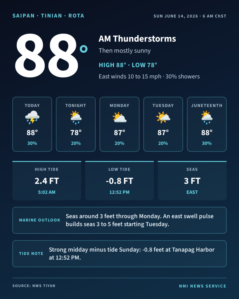
SAIPAN — The Marianas can expect a wet start to Sunday with scattered showers and isolated thunderstorms in the morning, giving way to mostly sunny skies and isolated showers in the afternoon, the National Weather Service office in Tiyan said in its 6 a.m. forecast.
Highs will reach around 88 with east winds of 10 to 15 mph and a 30 percent chance of showers. Skies stay partly cloudy overnight with lows around 78. Monday and Tuesday hold in the upper 80s with a 20 percent shower chance, climbing back to 30 percent heading into Juneteenth on Friday.
On the water, light to gentle east to northeast winds and seas around 3 feet are expected through Monday. A pulse in east swell may build combined seas to 3 to 5 feet starting Tuesday and 4 to 6 feet by Thursday. Forecasters said island heating could generate locally heavy showers over the western coastal waters from the afternoon into the early evening, with isolated thunderstorms possible over the coastal waters in the morning.
Beachgoers will see another strong midday low tide. At Tanapag Harbor the tide drops to -0.8 feet at 12:52 p.m. Sunday, with a deeper -0.9 foot low following Monday at 1:47 p.m. Tinian and Rota also see midday minus tides Sunday, at -0.2 feet and -0.5 feet respectively.