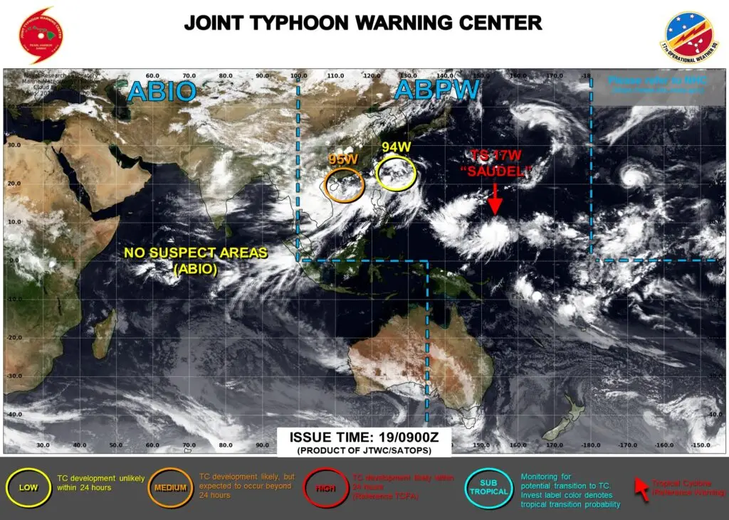

SAIPAN — Tropical Depression 17W strengthened into Tropical Storm Saudel and began tracking northward Wednesday evening, the Joint Typhoon Warning Center said, starting the turn forecasters have watched for all week and setting a forecast path that would carry the storm past Pagan at near-peak typhoon strength this weekend.
As of 4 p.m. Wednesday, Saudel carried maximum sustained winds of 40 mph with gusts to 52 mph, centered about 144 nautical miles east-northeast of Chuuk and moving north at 5 mph. The warning center said track speeds are expected to increase over the next 12 hours as a subtropical ridge south of Japan weakens and retreats, letting Saudel gain latitude before a second ridge building to the northeast takes over as the primary steering influence.
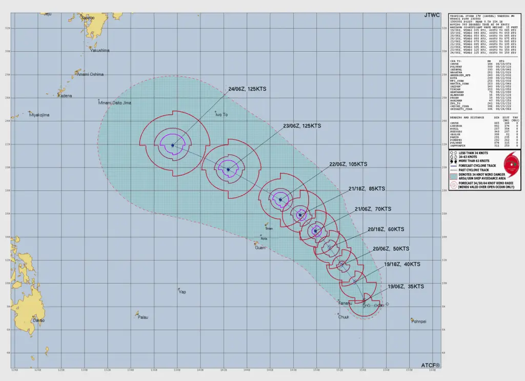
The forecast intensity ladder is steep. Saudel is expected to reach 50 knots by Thursday afternoon, cross the typhoon threshold around Friday afternoon at 70 knots and then rapidly intensify to 105 knots, about 120 mph, by Saturday afternoon as it takes advantage of what forecasters called strong dual channel outflow, sea surface temperatures over 30 degrees Celsius and high ocean heat content east of the Marianas. The forecast peak is 125 knots, about 145 mph, by Sunday afternoon. The warning center placed its intensity forecast on the higher end of the model envelope, and noted multiple rapid intensification aids have triggered that suggest an even quicker climb is possible.
The closest-point-of-approach table on the warning now puts numbers on the Northern Islands threat. Saudel is forecast to pass about 10 nautical miles from Pagan and 16 nautical miles from Alamagan late Saturday night, with Agrihan at 43 nautical miles early Sunday, all at or near typhoon intensity above 105 knots. Anatahan’s closest approach is about 78 nautical miles Saturday evening. For the populated southern islands, the forecast keeps Saipan’s closest approach near 143 nautical miles and Tinian’s at 151 around midafternoon Saturday, with Rota at 209 nautical miles.
Track confidence through Saturday is high, the center said, with model guidance in good agreement and cross-track spread of about 100 nautical miles at 72 hours, widening after the weekend. The trajectory is forecast to bend more west-northwestward beyond Saturday.
No tropical storm or typhoon watches or warnings are in effect for the Marianas as of Wednesday night. The National Weather Service has said watches would be issued about 48 hours before the onset of tropical storm conditions, and that a local statement would add Agrihan, Alamagan and Pagan when watches post. The weather service has urged preparation and communication for the few people known to be in the northern islands.
JTWC warnings on Saudel continue every six hours, with the next due at 1 a.m. Thursday.