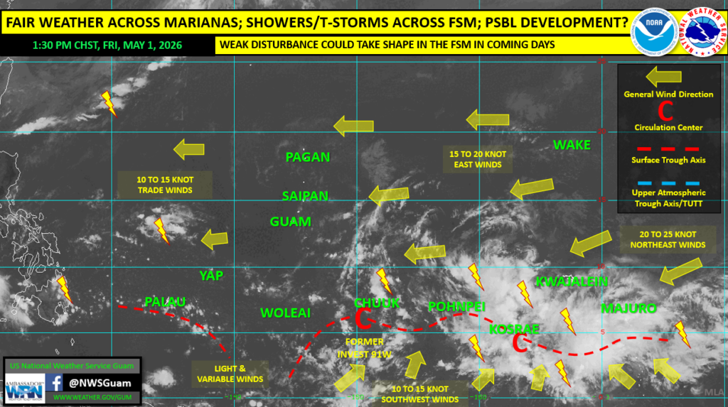
SAIPAN — Fair weather will persist across the Marianas through the weekend and into early next week, according to a regional weather outlook issued Friday by National Weather Service Guam Weather Coordination Meteorologist Landon Aydlett.
Trade winds of 10 to 15 knots will keep combined seas elevated at around 5 to 8 feet over the next few days, with a moderate risk of rip currents and surf reaching 7 to 8 feet along north and east-facing reefs and beaches. Residents and mariners should remain cautious in the water.
Further south across Micronesia, showers and thunderstorms are persisting across Chuuk, Pohnpei and Kosrae states through the weekend, with brief gusty winds and locally heavy rainfall possible. A cross-equatorial wind flow is converging northward into the Federated States of Micronesia, maintaining the unsettled pattern.
Invest 91W, which had been monitored for tropical development, was closed by the Joint Typhoon Warning Center Thursday. However, NWS Guam said another disturbance could take shape in the coming days out of eastern Micronesia. Global numerical models continue to favor tropical cyclone development in long-range scenarios beyond five to seven days, but Aydlett cautioned that any such development remains speculative and subject to high uncertainty.
“Any potential TC threat for us in the coming week remains speculative,” Aydlett said. “We need to first see a developing tropical disturbance at the surface in the FSM. This could happen overnight, this weekend, or Monday — and in some cases, not at all.”
For the Marianas, NWS Guam is advising business as normal heading into the weekend.