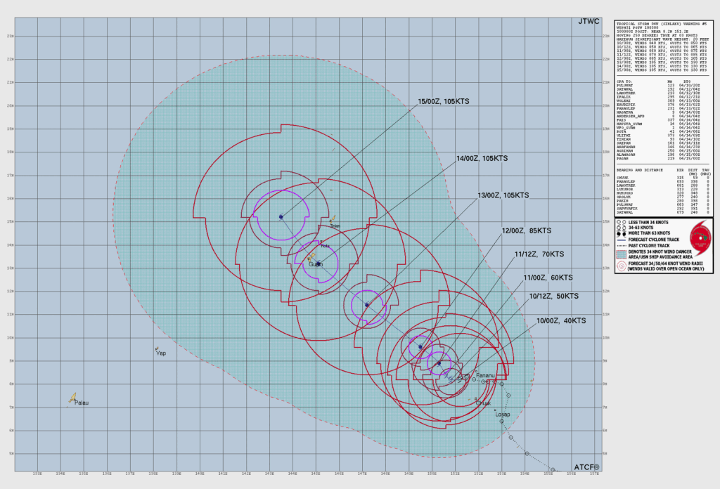
SAIPAN — What began earlier this week as Invest 90W has intensified into Tropical Storm Sinlaku, designated 04W by the Joint Typhoon Warning Center, and is now on a track toward the Marianas, the CNMI Office of Homeland Security and Emergency Management announced Friday at 12:45 p.m.
As of the advisory, Sinlaku was located north-northwest of Chuuk, about 605 miles southeast of Saipan, moving northwest at 3 mph. JTWC has the storm moving toward the Marianas with a potential to track near Guam. The range of possible tracks is narrowing and is expected to continue doing so over the next 12 to 24 hours.
HSEM is warning residents to prepare for the potential of tropical storm or typhoon-force winds, with the most likely arrival time around Monday. The Northern Islands could see breezy and choppy conditions as early as this weekend, with potential tropical-storm-force winds around Tuesday. Saipan, Tinian and Rota should expect 3 to 5 inches of locally heavy rainfall, with totals shifting depending on the storm’s track.
A High Rip Current Risk remains in effect through Sunday afternoon. A Small Craft Advisory remains in effect through Sunday night.
HSEM is advising residents to secure loose items including tents, canopies, tarps and trash bins, clear drainage areas and unblock storm drains in flood-prone areas, and avoid driving through flood waters.