SAIPAN — The Mariana Trench will not save you. Neither will the reef.
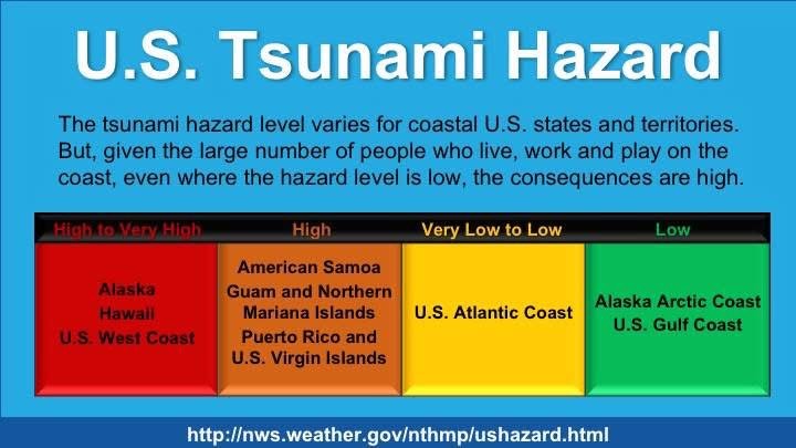
Those are among the persistent myths that National Weather Service meteorologist Landon Aydlett and researchers at the International Tsunami Information Center are working to dispel in a public education document on tsunami risk for Guam and the CNMI, a region the federal government classifies as facing a “high” tsunami hazard.
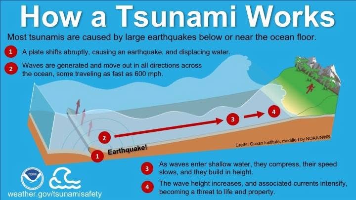
Guam and the CNMI sit on the Mariana Plate within the Pacific Ring of Fire, directly adjacent to the Mariana Trench, part of the Izu-Bonin-Mariana Arc subduction system where the Pacific Plate is thrust beneath the smaller Mariana Plate. NOAA modeling has found that a magnitude 9.0 earthquake within the Mariana Trench would represent the single greatest tsunami threat to the islands, with waves potentially arriving in as little as 10 to 45 minutes. Tsunamis from the Philippine Trench could arrive within two to three hours, and those from the Nankai Trough within two and a half to three and a half hours.
Despite that proximity to risk, a number of widely held beliefs in the region suggest the islands are immune.
The claim that the Mariana Trench protects the islands by absorbing wave energy is, according to the document, flatly incorrect. The trench is itself a tsunami source. The depth of water affects the speed of a tsunami wave but not its energy. Aydlett and his co-authors point to the 2009 Samoa tsunami as a cautionary parallel: residents near the Tonga Trench, the world’s second deepest behind the Mariana Trench, held similar beliefs about their natural protection. A series of earthquakes that year generated waves more than 20 meters high in some areas, killing nearly 200 people.
The belief that the fringing reef surrounding parts of Saipan will stop a tsunami is also only partially supported by science. Modeling conducted by researchers found that reefs off Garapan appeared to dampen wave amplitudes in some scenarios, but the same was not found for fringing reefs off Rota, Tinian or other coastal areas of Saipan. Reef dissipation is not elimination.
The idea that the Marianas have never experienced a tsunami is also false. Historical records document at least three tsunamis causing damage at multiple locations on Guam, in 1849, 1892 and 1993. The 2011 Tohoku earthquake in Japan, magnitude 9.1, produced waves with amplitudes up to two feet in Saipan and 18 inches on Guam. As recently as July 2025, a magnitude 8.8 earthquake off Kamchatka, Russia generated measurable tsunami waves at both Saipan, at 0.7 feet, and Guam, at 0.4 feet.
Aydlett and his colleagues also caution that tsunami impact varies dramatically by location. The direction and energy distribution of a tsunami depends on the characteristics of the earthquake rupture zone and the ocean depth along the wave’s path. Two beaches in close proximity can experience very different impacts from the same event. The first wave is also not always the largest.
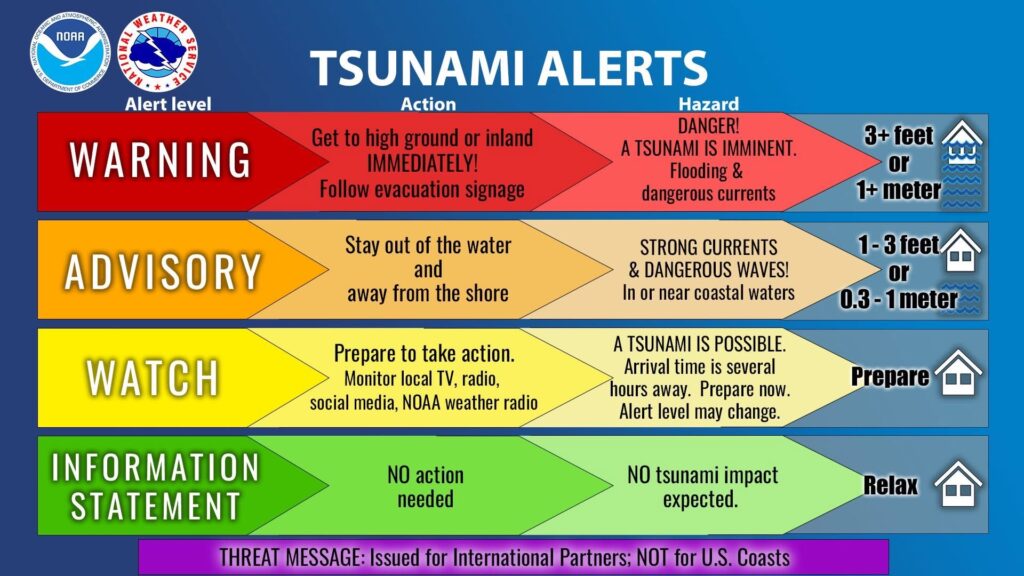
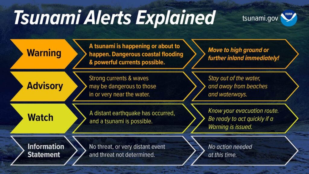
For residents, the alert system works as follows. A Tsunami Warning means dangerous coastal flooding and powerful currents are expected and residents should move to high ground or inland immediately. A Tsunami Advisory means strong currents and waves dangerous to those in or very near the water are expected and residents should stay out of the water and away from beaches and waterways. A Tsunami Watch means potential hazards have not yet been determined and residents should stay tuned for updates and be prepared to act. An Information Statement means no significant threat has been identified.
Tsunami watches, advisories and warnings for Guam and the CNMI are issued by the Pacific Tsunami Warning Center in Honolulu. More information is available at weather.gov/gum.