NWS Guam says system is struggling to survive but remnant circulation still expected to bring rain, gusty winds through Friday
SAIPAN — Tropical Depression Nuri has deteriorated significantly overnight and may no longer exist as a tropical depression by the time it reaches the Mariana Islands, NWS Guam said Thursday morning, though residents should still expect showers, thunderstorms and gusty winds through Friday evening.
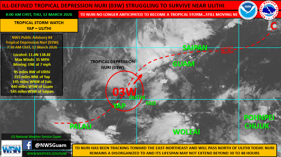
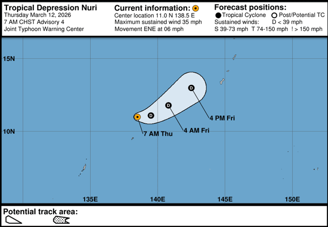
In an 8:00 a.m. ChST alert Thursday, NWS Guam Weather Coordinator Landon Aydlett said early morning satellite imagery showed an increasingly ill-defined and disorganized system, with the core of deep convection no longer present near the circulation center. The Joint Typhoon Warning Center reduced the forecast track to 36 hours in its 7:00 a.m. bulletin, citing a dissipating low-level circulation center and an overall lack of defined surface structure.
“Nuri is no longer anticipated to become a tropical storm,” Aydlett said in the alert.
As of 7:00 a.m. ChST Thursday, Nuri was located near 11.0N 138.8E, approximately 95 miles northwest of Ulithi, 115 miles north-northeast of Yap, 440 miles west-southwest of Guam and 545 miles west-southwest of Saipan. It was moving east-northeast at 7 mph with maximum sustained winds of 35 mph.
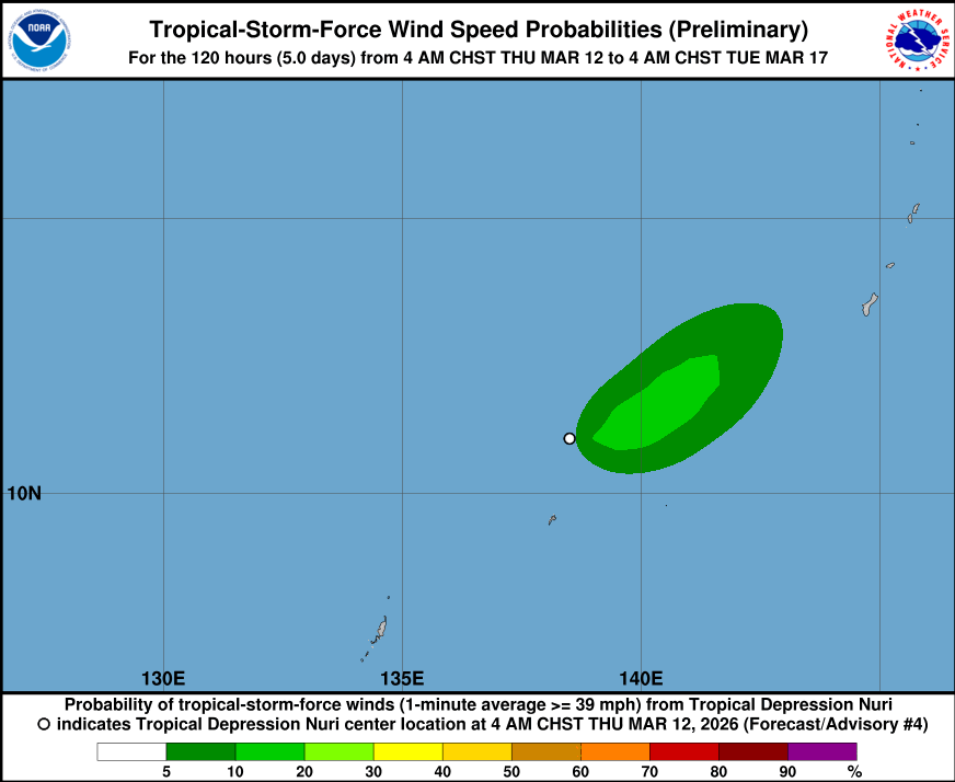
NWS Guam said Nuri may dissipate more rapidly than forecast as the surrounding environment becomes less favorable for development. However, even if the system falls apart before reaching the islands, its remnant circulation and associated troughing are still expected to produce showers, thunderstorms, gusty winds and the potential for locally heavy rainfall across the Marianas through Friday evening.
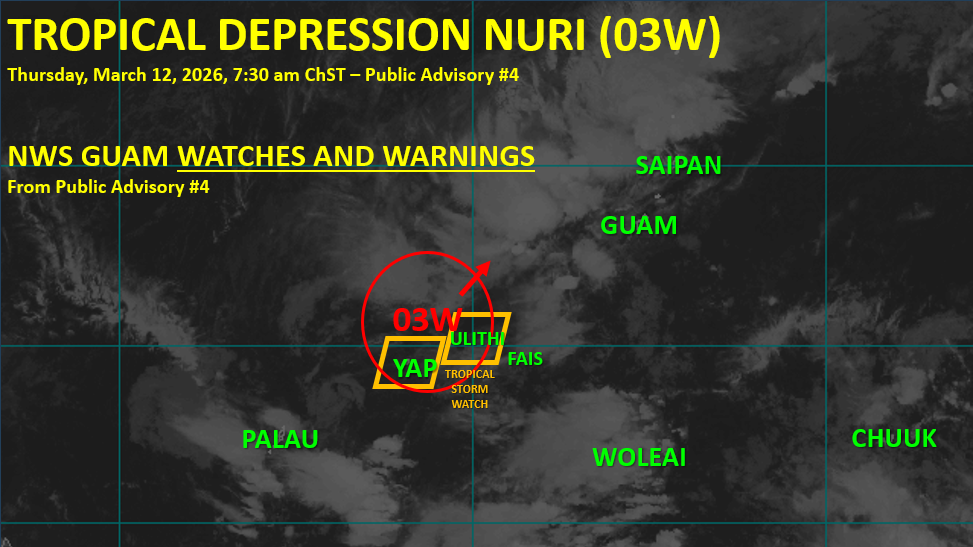
A Tropical Storm Watch remains in effect for Yap Proper and Ulithi in western Yap State, where tropical storm force winds of 39 mph or greater remain possible as the system passes just north of those locations.
Residents across Yap State, Guam and the CNMI are advised to continue monitoring forecasts from NWS Guam, WSO Yap and local emergency management until the system clears the area and conditions improve.