Weather Service issues supplemental update on tropical disturbance threatening CNMI, Guam weekend
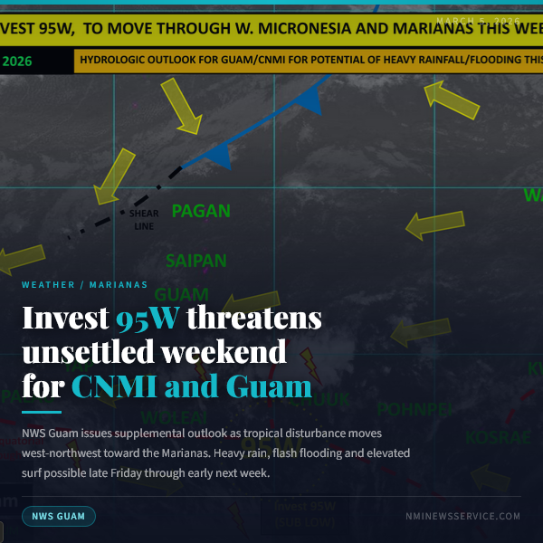
SAIPAN — The National Weather Service issued a supplemental outlook Thursday on a tropical disturbance southwest of Chuuk that forecasters say could bring heavy rainfall, elevated surf and breezy winds to the Northern Mariana Islands this weekend.
Windy, rough surf and hazardous marine conditions continue across CNMI through midweek
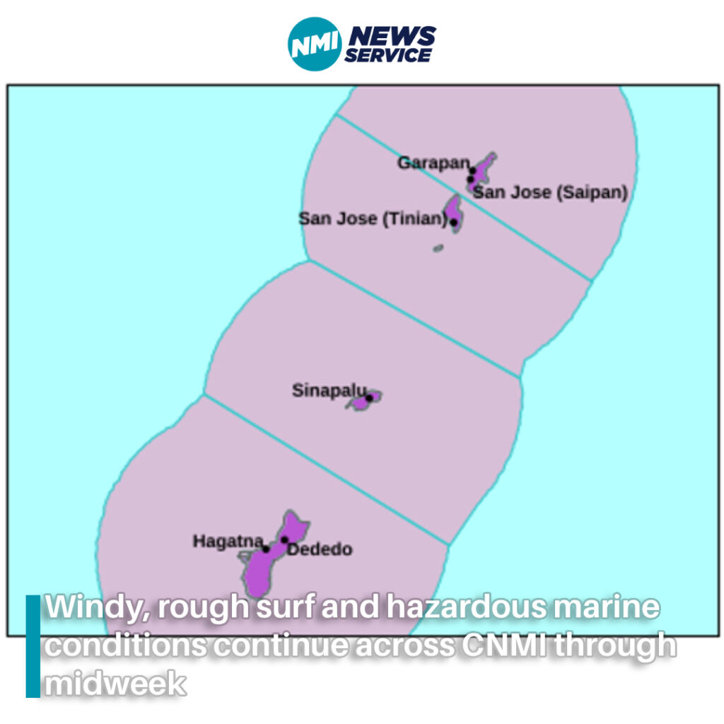
Saipan — The Commonwealth is expected to remain windy with rough seas, hazardous surf and dangerous rip currents through at least Wednesday night or Thursday as a weakening shear line and strong high pressure north of the Marianas continue to affect the region.
NWS: Fair weather for Marianas, but high risk of rip currents continues
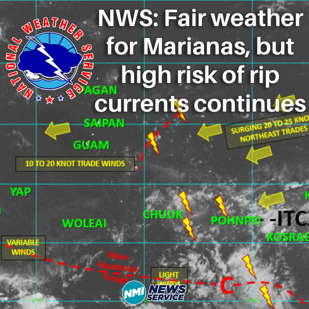
SAIPAN — The National Weather Service in Guam says we’re in for mostly pleasant weather over the next few days in the Marianas, but beachgoers will still need to watch out for dangerous rip currents.
Wind and Rain on the way!
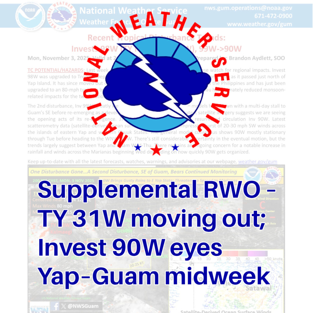
Heads up, Guam & CNMI: TY 31W is leaving, but Invest 90W is trying to spin up. Likely stationary thru Tue, then WNW–NNW with a Wed–Thu window between Yap & Guam. Expect rain/wind to tick up starting Wed.
So what the heck is a Hydrologic Outlook?
Hydrologic Outlook = early heads-up about possible flooding.
It’s issued by the National Weather Service when heavy rain is likely to cause flash flooding, urban/poor-drainage flooding, or small stream rises, but confidence/timing isn’t firm enough yet for a Watch.
Tropical Disturbance Brings Showers, Advisories Across Marianas
Small Craft Advisory in effect for Saipan and Tinian; Coastal Flood Advisory for Majuro