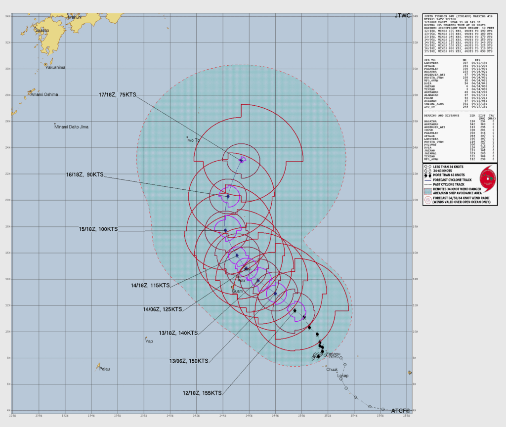
SAIPAN — Super Typhoon Sinlaku reached maximum sustained winds of 180 mph Monday morning and remains on a track forecast to bring the storm center near or over Tinian and Saipan, according to HSEM Bulletin 9 issued at 8 a.m.
The storm was located 315 miles southeast of Saipan as of 7 a.m., moving northwest at 9 mph. HSEM said the latest forecast track shifted slightly southward from the previous bulletin but passage near or over Tinian and Saipan is still expected. Sinlaku is forecast to gradually weaken through the next several days but will remain an extremely dangerous storm at landfall.
Tropical storm-force winds are expected to reach Guam, Rota, Tinian and Saipan this evening or tonight. Typhoon-force winds are expected to begin reaching Rota, Tinian and Saipan Tuesday or Tuesday afternoon. Typhoon-force winds extend 60 miles from the center, with tropical storm-force winds reaching up to 275 miles to the northeast and 215 miles elsewhere.
A Typhoon Warning remains in effect for Saipan, Tinian and Rota. Typhoon Condition II remains in effect for Saipan, Tinian and Rota. Tropical Storm Condition III remains in effect for Pagan and Alamagan.
Residents must be in their shelter now. Do not wait. Conditions will deteriorate rapidly this evening. The CNMI EOC State Warning Point can be reached at 670-237-8000 or 670-664-8000. NOAA Weather Radio is available at 211. An intermediate bulletin is scheduled for 11 a.m., followed by the next full bulletin at 2 p.m.