SAIPAN — With community sports returning to weekend rhythms, the drier trade pattern could be good news for scheduling and field conditions as Little League baseball resumes, but families should keep an eye on the surf and marine advisories if practices or downtime include beach and reef areas later in the day or during the evening tide cycle.
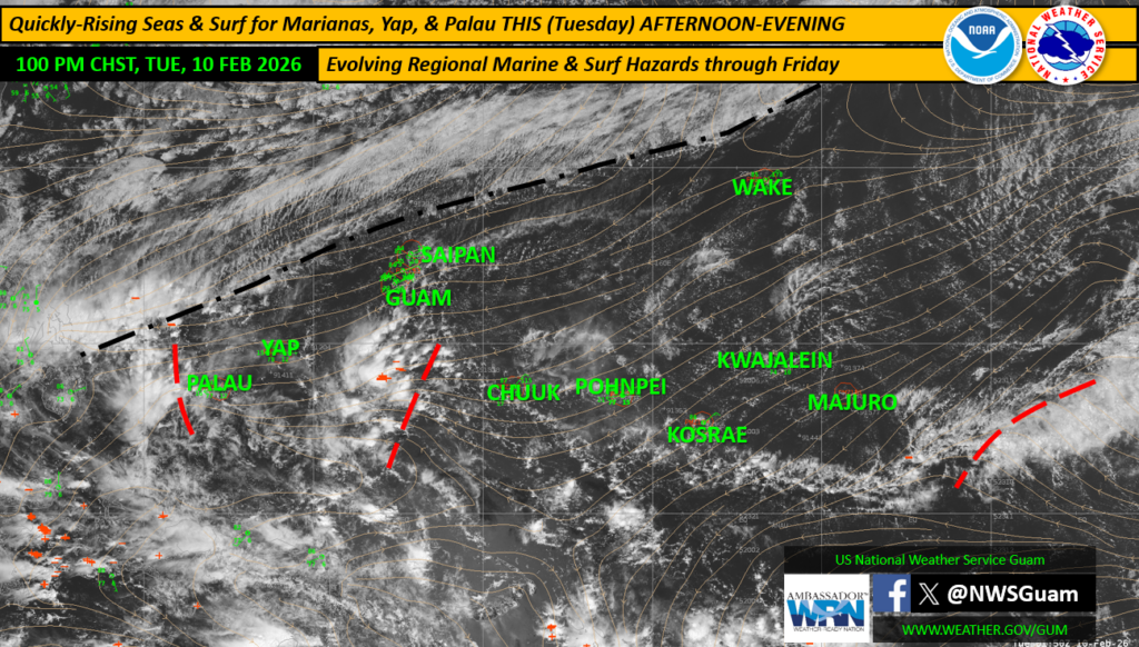
A broad shear line that dropped south from Japan is beginning to stall over the far Northern Mariana Islands, a setup that the National Weather Service in Guam says will allow a drier easterly trade-wind pattern to persist over the CNMI and Guam through the week.
The bigger concern for the Marianas in the near term is in the water. The outlook warns that a large northwest swell, generated by strong northwest winds behind the shear line, will continue moving toward the Marianas, with the larger, long-period swell expected to arrive as early as this afternoon for some locations and after sunset elsewhere.
The National Weather Service specifically urged caution for anyone planning reef activities along western and northern coastlines, noting conditions may feel calm earlier in the day but can change rapidly later.
For local boaters and beachgoers, the outlook lists marine hazards in effect for the Marianas, including a High Surf Advisory for Guam/CNMI and a Small Craft Advisory for the Marianas.
The outlook also states there is no tropical cyclone potential or hazards at this time.
With community sports returning to weekend rhythms, the drier trade pattern could be good news for scheduling and field conditions as Little League baseball resumes, but families should keep an eye on the surf and marine advisories if practices or downtime include beach and reef areas later in the day or during the evening tide cycle.
The weekly outlook also notes that drought concerns remain minimal for most of the region based on recent rainfall trends, though stronger northeast trades could limit rainfall in the week ahead across parts of Micronesia.