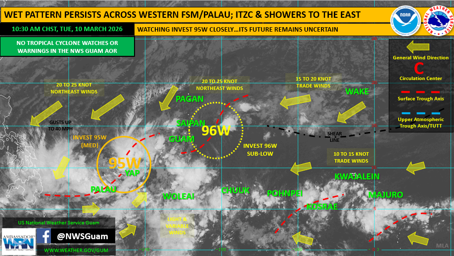
SAIPAN — The CNMI Homeland Security and Emergency Management office issued a Special Weather Statement Tuesday afternoon warning that Invest 95W has become better organized and is now under a Tropical Cyclone Formation Alert, meaning formation of a tropical depression is likely within the next 24 hours.
The vast majority of forecast models now indicate the system will strengthen into a tropical depression as it continues moving northeast. Forecasters say the track has been consistent for the better part of a week, with the system expected to either pass through the Marianas or parallel the region just to the west. Either scenario carries the same weather impact for Saipan, Tinian and Rota.
Heavy rainfall is expected to redevelop over the next 48 to 72 hours. Isolated thunderstorms are possible, and any heavier shower or thunderstorm could produce wind gusts of 35 to 45 mph.
Timing: Wednesday through Thursday night Rainfall: 2 to 4 inches, with locally higher amounts possible Winds: Sustained 20 to 30 mph, with gusts of 35 to 45 mph possible near heavier showers or thunderstorms
Governor David M. Apatang is advising residents of Saipan, Tinian and Rota to secure loose objects, complete any necessary errands, and continue monitoring forecasts through local media and NOAA Weather Radio on 162.5 MHz. For updates, contact the CNMI EOC State Warning Point at (670) 237-8000 or (670) 664-8000. Residents of the Northern Islands should monitor High Frequency Single Side Band Radio on frequency 5.205.0.