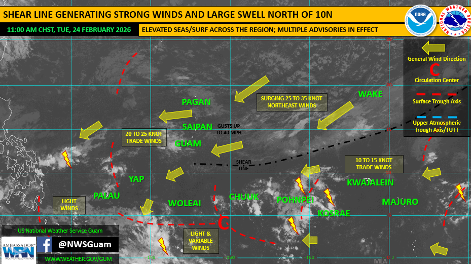
Saipan — The Commonwealth is expected to remain windy with rough seas, hazardous surf and dangerous rip currents through at least Wednesday night or Thursday as a weakening shear line and strong high pressure north of the Marianas continue to affect the region.
The National Weather Service in Guam said scattered showers and isolated thunderstorms are expected across the Marianas through Wednesday, with conditions gradually improving into the weekend. The outlook indicates the strongest impacts for the CNMI remain tied to marine and coastal hazards, including large seas, high surf and strong rip currents.
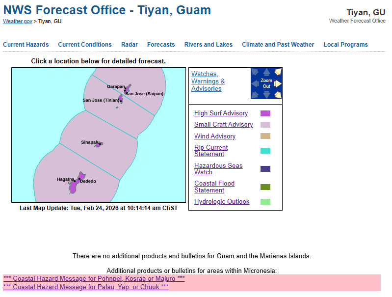
For Saipan, Tinian and Rota, the outlook warns that seas and surf are expected to build further into Wednesday, with hazardous surf possibly reaching dangerous levels of 15 feet or more. Multiple advisories remain in effect for Guam and the CNMI, including hazardous seas, high surf, small craft conditions, high risk of rip currents, and hydrologic and coastal flood concerns. A wind advisory is also listed for Tinian and Saipan.
Guam remains under the same weather pattern and is also expected to see scattered showers and isolated thunderstorms through Wednesday. The outlook notes the potential for locally heavy rainfall through Wednesday at Guam and Rota before conditions improve over the weekend.
On the broader regional picture, NWS Guam reported no tropical cyclone threats or areas of development within its area of responsibility at this time. The drought outlook continues to show near to above normal rainfall for much of the region, including the Marianas.
Residents, boaters and beachgoers in the CNMI should use extra caution through midweek, especially along exposed coastlines and near reef lines where surf and rip currents remain dangerous.