SAIPAN — A showery pattern is expected to hang on across the Commonwealth through Wednesday, with brief heavy showers possible tonight along with gusty winds, according to the National Weather Service forecast office in Guam’s weekly regional outlook issued Tuesday morning.
Forecasters said conditions should improve in the second half of the week before another round of showers is expected to arrive this weekend, likely tied to a separate disturbance currently in Micronesia.
Marine conditions are also expected to gradually settle. Combined seas of 7 to 9 feet are forecast to continue subsiding over the next few days, falling to 5 to 7 feet by Thursday, the outlook said. Surf is also trending down, but remains elevated, with a high risk of rip currents for Guam and the CNMI.
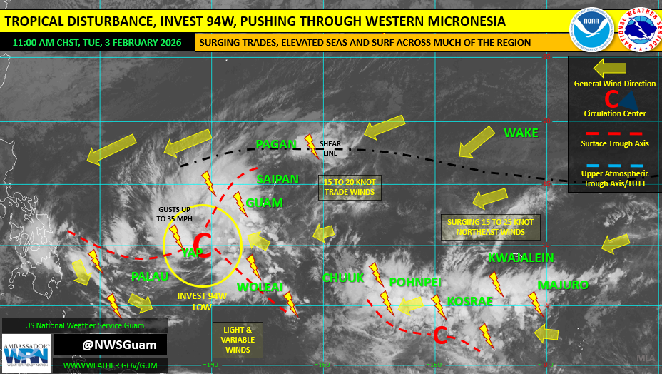
In the broader picture, the shear line that brought locally heavy rainfall and hazardous seas/surf to the Marianas over the weekend has retreated north and was described as passing over Pagan and stretching eastward beyond Wake Island and the Date Line.
The outlook also noted Invest 94W in Yap State is generating a broad area of showers and thunderstorms that extends into the Philippine Sea west of Guam and the CNMI. It was rated low for development in the next 24 hours, with any significant development expected to occur west of Yap and Palau.
National Weather Service Guam advised residents that local conditions can change significantly within a day or two of the weekly outlook and urged the public to keep up with the latest forecasts and hazard information.