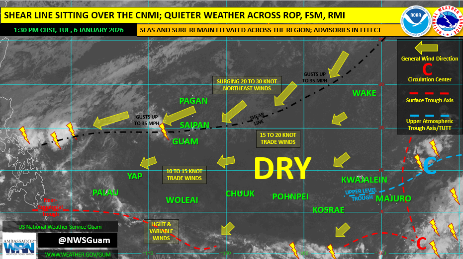
SAIPAN — A shear line sitting over Saipan, Tinian and Rota is bringing patchy showers, cloud cover and gusty winds for a second day, according to the National Weather Service forecast office in Guam’s Weekly Regional Weather Outlook issued Tuesday afternoon.
NWS Guam said wind gusts have been reaching up to 30 mph and the shear line is expected to weaken, with drier weather expected by Wednesday for the CNMI.
For the remainder of the week, forecasters said the CNMI can expect improved weather with spotty showers and moderate to fresh trade winds of 15 to 20 mph. Marine conditions remain a concern, with NWS noting seas and surf remain elevated. Combined seas are forecast to hold around 5 to 7 feet for the latter half of the week, before rising again this weekend, the outlook said.
NWS Guam said hazardous surf of 9 feet is expected to subside overnight to 8 feet along north and east facing reefs, and the outlook lists a High Surf Advisory/High Risk of Rip Currents for Guam, Rota, Tinian and Saipan.
The outlook also states there are no suspect areas for tropical development in the NWS Guam area of responsibility through the next week.
In its drought section, NWS Guam reported no regional drought-related concerns, aside from abnormally dry (D0) conditions across the CNMI and the northern Marshall Islands, and said it expects near-normal rainfall across much of the region through mid-January.