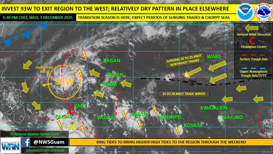
SAIPAN — The National Weather Service in Guam says the CNMI can expect a fairly dry pattern with moderate to fresh trade winds (15 to 20 mph) and only a few showers, according to its Weekly Regional Weather Outlook issued Wednesday, Dec. 3, 2025.
NWS said a surface trough could bring scattered showers and isolated thunderstorms late Thursday and Friday, followed by improved weather over the weekend.
Marine conditions remain the bigger concern for the CNMI, with seas and surf elevated due to a long-period north swell and trade wind swell. As of 1 p.m., NWS said a High Surf Advisory remained in effect for north-facing reefs, along with a high rip current risk for north and east reefs, though conditions are expected to gradually subside over the next few days.
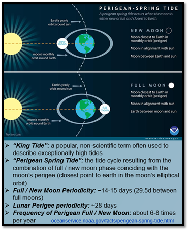
The outlook also flagged the ongoing king tide cycle tied to the Dec. 4 full moon, with nuisance/minor coastal flooding possible in low-lying, flood-prone coastal areas over the next few days.
Regionally, NWS said Invest 93W is west of the Marianas and moving westward, and poses no threat to the Marianas.