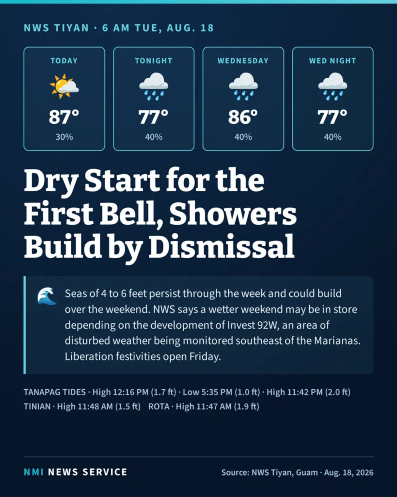

SAIPAN — Students across the Marianas return to class Tuesday under a mostly dry morning sky, but the National Weather Service said showers and isolated thunderstorms will build through the afternoon as the islands settle into an unsettled pattern expected to last through midweek.
Saipan and Tinian can expect a partly sunny start with isolated morning showers before conditions turn mostly cloudy with scattered showers and isolated thunderstorms in the afternoon, the weather service said in its 6 a.m. forecast from Tiyan, Guam. Winds will be light and variable with highs around 87. The chance of showers is 30 percent Tuesday, rising to 40 percent Tuesday night as northeast winds pick up to 10 to 15 mph. Overnight lows will settle around 77.
Rota carries a slightly wetter outlook, with a 40 percent chance of showers throughout the day and highs around 86.
Wednesday holds the same script for all three islands: mostly cloudy skies, scattered showers and isolated thunderstorms, highs around 86 and a 40 percent chance of rain.
On the water, forecasters said light and variable winds will turn more northerly tonight, with combined seas of 4 to 6 feet persisting throughout the week and possibly building over the weekend. A wetter weekend may be in store depending on the development of Invest 92W, an area of disturbed weather being monitored southeast of the Marianas, the weather service said, adding that the situation will continue to be monitored closely.
The timing puts the disturbance on a watch list for the islands’ biggest weekend of the summer, with 80th Liberation Day festivities opening Friday at the Civic Center grounds in Susupe.
At Tanapag Harbor, high tide reaches 1.7 feet at 12:16 p.m. Tuesday, with a low of 1.0 feet at 5:35 p.m. and a higher high of 2.0 feet at 11:42 p.m. Tinian sees a high of 1.5 feet at 11:48 a.m. and Rota a high of 1.9 feet at 11:47 a.m.