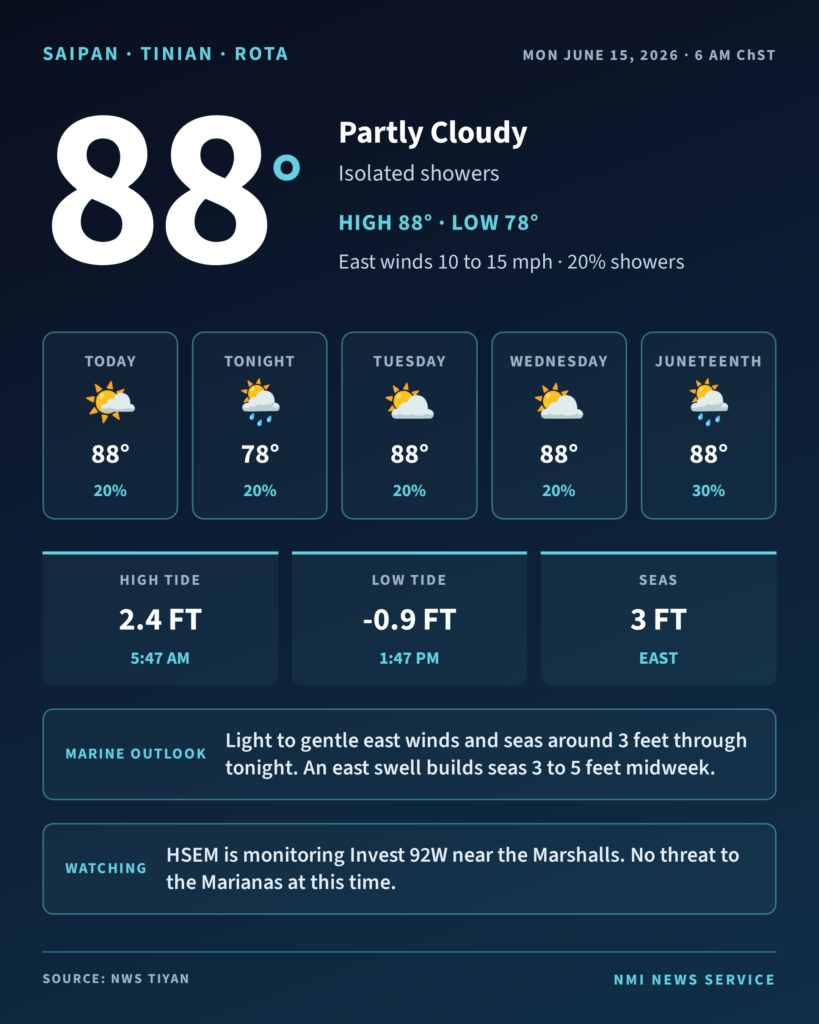
SAIPAN — The Marianas can expect a partly cloudy Monday with isolated showers, highs around 88 and east winds of 10 to 15 mph, the National Weather Service office in Tiyan said in its 6 a.m. forecast.
The chance of showers holds at 20 percent through the day and overnight, with scattered showers possible at night as lows settle around 78. Tuesday and Wednesday stay in the upper 80s with a 20 percent shower chance, climbing to 30 percent from Thursday into Juneteenth on Friday.
On the water, light to gentle east to northeast winds and seas around 3 feet are expected through tonight. A pulse in east swell may build combined seas to 3 to 4 feet Tuesday and 4 to 5 feet by midweek. Forecasters said daytime island heating will bring increased showers over the western coastal waters in the afternoon and early evening.
Beachgoers will see another strong midday low tide. At Tanapag Harbor the tide drops to -0.9 feet at 1:47 p.m. Monday, with a matching -0.9 foot low Tuesday at 2:41 p.m. Tinian and Rota also see midday minus tides both days.
Separately, the CNMI Homeland Security and Emergency Management Office said Sunday it is monitoring Invest 92W, a weak tropical disturbance near the Marshall Islands moving generally toward the Marianas. The office said the system is broad and disorganized, that any development would be gradual, and that now is a time for awareness and readiness rather than alarm.