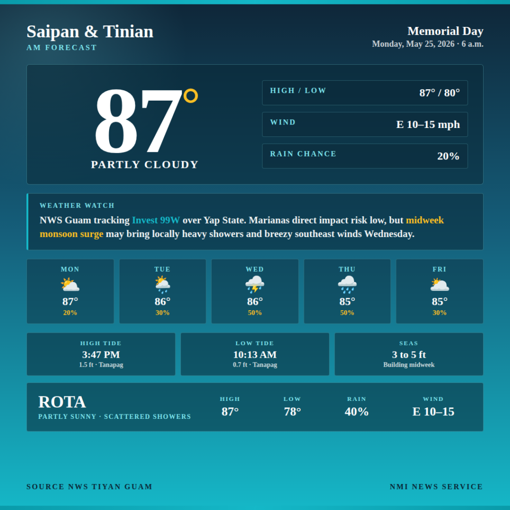
SAIPAN – Saipan and Tinian can expect a partly cloudy and warm Memorial Day Monday with isolated showers, the U.S. National Weather Service in Guam said in its 6 a.m. forecast. East winds 10 to 15 mph, highs around 87, and a 20 percent chance of showers will hold through the day.
The bigger forecast story is the midweek build. NWS Guam is tracking Invest 99W, a slowly developing tropical disturbance over Yap State, and while the direct impact risk on the Marianas remains low, the broader monsoon pattern interacting with the system is expected to bring locally heavy showers, isolated thunderstorms, and breezy southeast winds beginning Tuesday night and lasting into Thursday.
Rain chances climb from 30 percent Tuesday to 50 percent Wednesday and Thursday, the agency said. East winds shift to southeast and pick up to 15 to 20 mph through midweek. Lows hold steady around 80.
Rota will see scattered showers and isolated thunderstorms today with a 40 percent rain chance, highs around 87, and lows around 78. The southern island faces a more active midweek, with NWS Guam calling for numerous locally heavy showers and scattered thunderstorms Wednesday with a 60 percent shower chance, climbing to 70 percent Wednesday night.
For Marianas waters, gentle to moderate easterly winds are expected through tonight before becoming moderate Tuesday, the agency said. Winds could increase to fresh and shift southeast Wednesday depending on the track and strength of 99W. Combined seas have dropped to 3 to 5 feet and are expected to gradually rise beginning tonight as a longer-period north swell mixes with the easterly trade wind swell. An additional southwest swell is expected to fill in Wednesday or Wednesday night and could push seas to peak late this week. The size of that southwest swell remains highly uncertain and depends on the strength and track of 99W. Seas are not currently expected to reach hazardous criteria, but NWS Guam said the situation will be monitored closely.
At Tanapag Harbor, Saipan, high tide arrives at 3:47 p.m. at 1.5 feet, with low tide at 10:13 a.m. at 0.7 feet. Tinian high tide is at 3:23 p.m. at 1.4 feet, low tide at 9:34 a.m. at 0.4 feet. Rota high tide is at 3:22 p.m. at 1.8 feet, low tide at 9:51 a.m. at 1.0 feet.
NMI News Service will continue to follow Invest 99W and update forecast coverage as conditions evolve through the week.