SAIPAN — The National Weather Service in Guam is tracking a potential tropical circulation forming in Eastern Micronesia over the next several days that could affect portions of the region during the May 3 to 6 time frame, as the CNMI continues recovery operations from Super Typhoon Sinlaku.
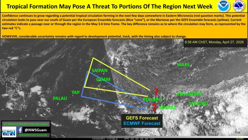
Forecasters said confidence is growing that a tropical circulation will develop, but the location of formation remains the key unknown. The American GEFS ensemble model shows a track toward the Marianas, represented by a yellow cone on NWS graphics. The European ECMWF ensemble shows a track passing south of Guam, represented by a blue cone. The two potential formation areas are marked with question marks in the Eastern Micronesia region near Pohnpei and Kosrae.
NWS emphasized that considerable uncertainty remains regarding the system’s development potential, track and timing, all of which are subject to change.
The Marianas are already in a vulnerable state with more than 15,000 Saipan customers still without power, water recovery ongoing, and federal recovery operations across all three islands.
Residents and recovery personnel should monitor updates from the National Weather Service Guam at weather.gov/gum and on social media at @NWSGuam. NMI News Service will continue to track and report on any developments.