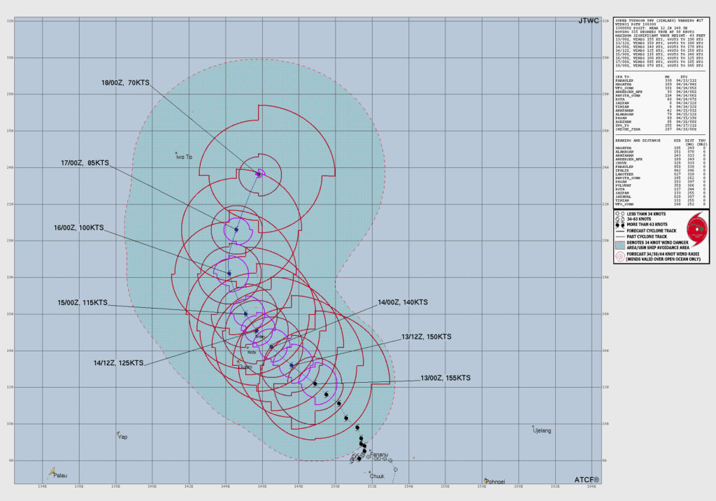
SAIPAN — The latest track from the Joint Typhoon Warning Center shows Super Typhoon Sinlaku has begun a gradual weakening trend but remains an extremely dangerous storm that will strike the Marianas as a Category 4 typhoon, with the refined track placing the center on a path directly between Tinian and Rota.
JTWC Warning 17, issued Monday, shows the storm’s maximum sustained winds decreasing from 155 knots at the time of issuance to 150 knots — approximately 173 mph — by Monday evening, and 140 knots by Tuesday morning at the point of closest approach to Saipan, Tinian and Rota. The storm is moving northwest at 8 knots, slightly slower than previous bulletins.
The bearing and distance table on the chart places Saipan, Tinian and Rota all within the direct impact zone, with the center forecast to pass near or between the islands. The storm is expected to continue weakening through the week, dropping to around 100 knots by Wednesday and 85 knots by Thursday, but will still be producing destructive typhoon-force winds as it moves through the island chain Tuesday.
The news that weakening has begun is meaningful but should not be misread as relief — a 140-knot storm at landfall is still a catastrophic event for Saipan and Tinian.