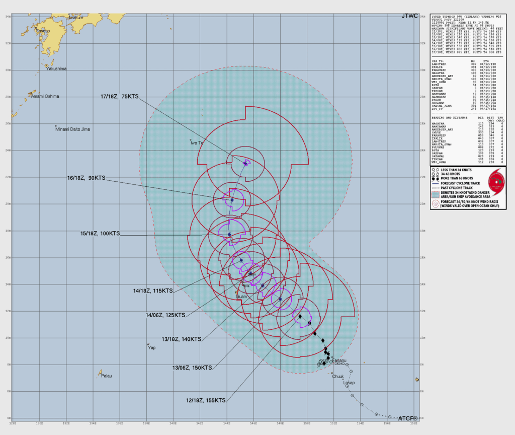
SAIPAN — The National Weather Service is forecasting gusts up to 180 mph and seas of 30 to 40 feet for Saipan and Tinian as Super Typhoon Sinlaku moves through the Marianas Tuesday into Wednesday, with conditions deteriorating rapidly beginning this afternoon.
The 10:25 a.m. zone forecast paints a grim picture for Saipan and Tinian. Tropical storm conditions are already expected today, with northeast winds increasing to 35 to 45 mph this afternoon and gusts to 65 mph. Tonight, winds climb to 45 to 65 mph with gusts to 85 mph.
Tuesday brings the full force of the storm. Northeast winds are forecast to increase from 60 to 70 mph in the morning to 95 to 105 mph near noon, then 110 to 125 mph later in the afternoon. Tuesday night, as the center passes, south winds of 130 to 150 mph are expected with gusts to 180 mph before winds decrease to 80 to 100 mph near midnight and 60 to 80 mph by early Wednesday morning. Widespread heavy showers and thunderstorms are forecast throughout with near 100 percent chance of rain.
Rota faces a less direct track but will still see sustained tropical storm to typhoon conditions. Typhoon conditions remain possible for Rota on Tuesday and Tuesday night, with northwest winds of 45 to 60 mph and gusts to 75 mph.
Coastal seas for Saipan and Tinian will build to 30 to 40 feet by Tuesday as Sinlaku moves through. Rota can expect seas of 20 to 30 feet. NWS noted typhoon-force winds could still affect Guam if the track shifts further south.
A Typhoon Warning, High Surf Warning, Flood Watch and Coastal Flood Watch all remain in effect for Saipan, Tinian and Rota. Conditions are expected to gradually ease through Wednesday and Thursday, with tropical storm conditions lingering into Wednesday night before winds subside.
Residents must be sheltered now and should not venture outside under any circumstances once winds begin to increase this evening.